Warning from MET Norway for Kyst- and fjordstroekene i Finnmark
2
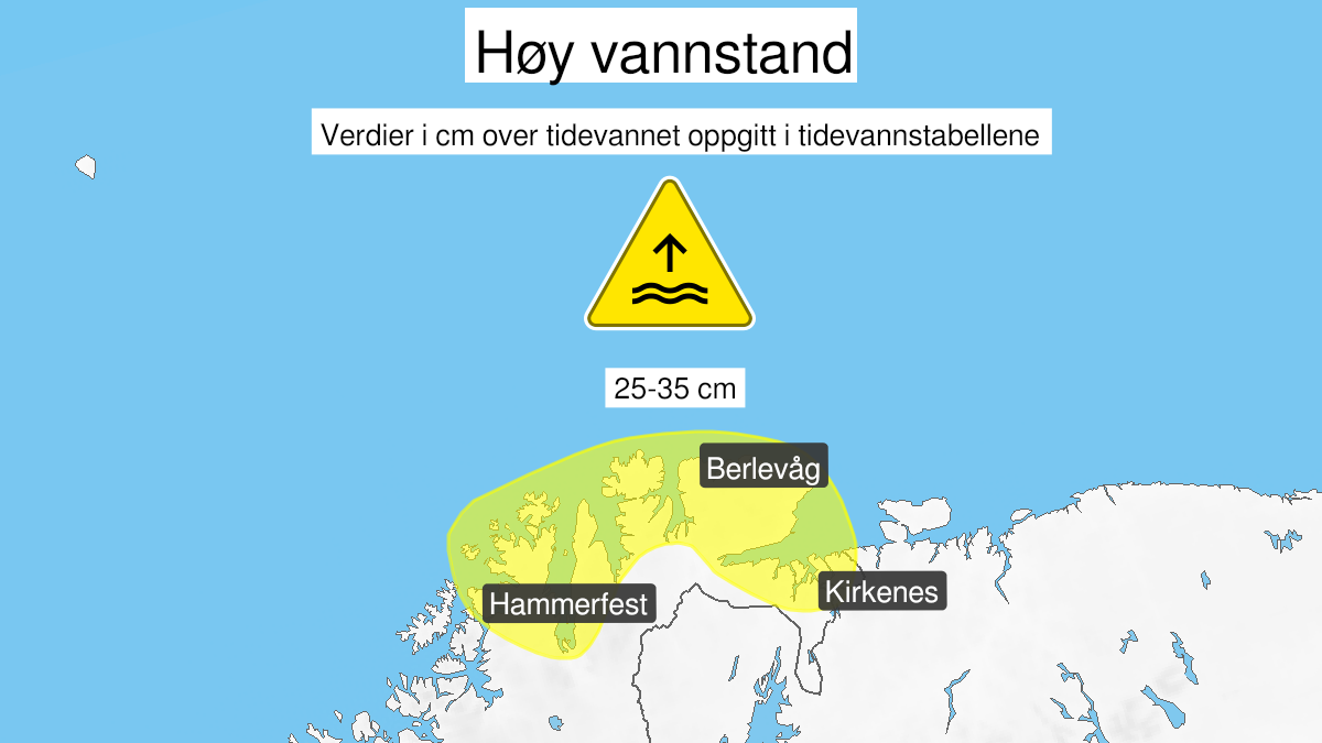
High water level, yellow level (MET)
Published:
Valid:
from 18.09.2020 16:00
to 19.09.2020 09:00
Warning
Water level at the coast and in the fjords
-
Sender: MET Norway
-
Danger ongoing: Friday, September 18, 2020, kl.4:00 PM
-
Danger decrease: Saturday, September 19, 2020, kl. 9:00 AM
-
Certainty: Likely > 50%
Consequence
Local flooding and risk of minor damage to infrastructure and buildings in the beach zone.
Advice
Be careful in coastal areas. Check the mooring of the boat and secure objects near the water in the coastal zone.
Description
Forecast for the area Fruholmen to Grense Jakobselv: Friday afternoon and early Saturday high water level is expected, estimated to 25-35 cm above the height given in the tide tables. The water level is expected at its highest Friday afternoon from 15-18 and early Saturday morning from 03-06. The highest top is expected early Saturday.