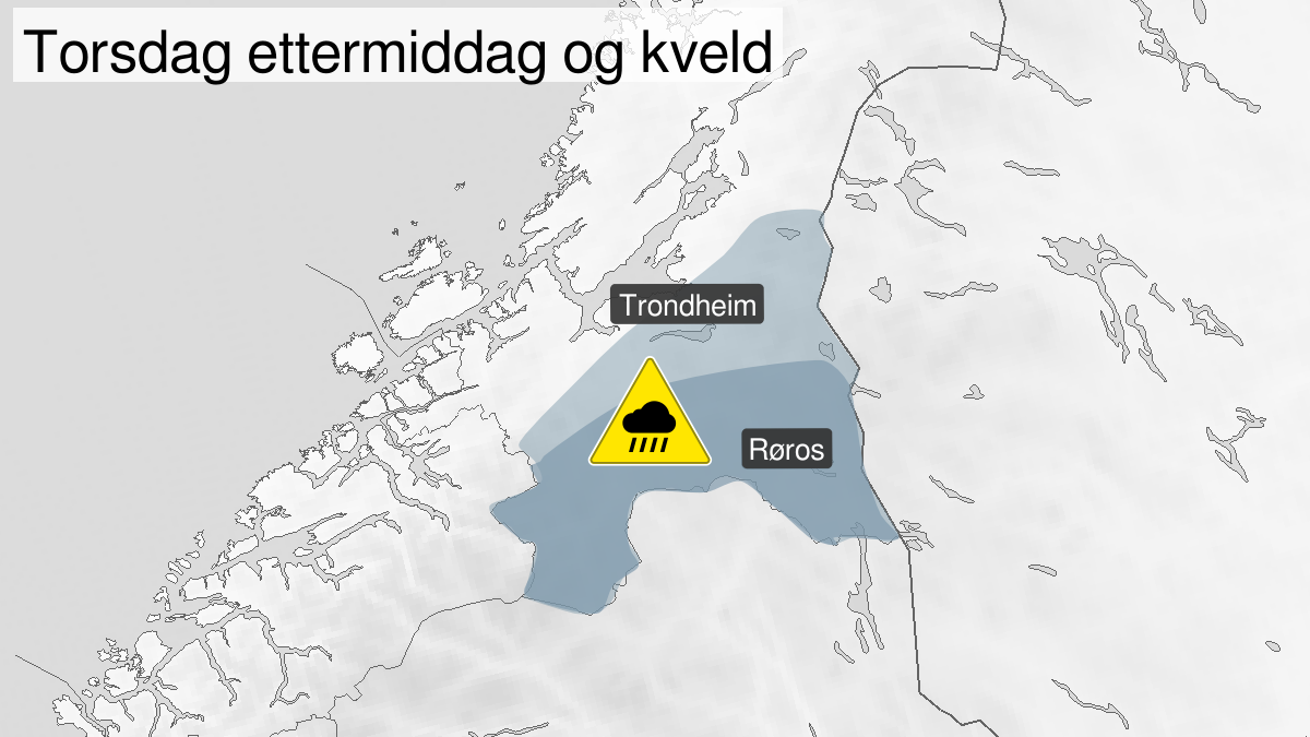
Warning from MET Norway for Southern and inner parts of Trøndelag
2
Heavy rainshowers, yellow level (MET)
Published:
Valid:
from 13.08.2020 14:00
to 13.08.2020 23:00
Warning
Rain flood
-
Sender: MET Norway
-
Danger ongoing: Thursday, August 13, 2020, kl.2:00 PM
-
Danger decrease: Thursday, August 13, 2020, kl. 11:00 PM
-
Certainty: Likely > 50%
Consequence
Risk of storm water in urban areas, local flooding, stream bank erosion, changing waterways, shallow landslides at locations impacted by showers. Hail, thunder and lightning, and strong wind gusts. Locally difficult driving conditions, especially at waterways. Roads may be closed. Road conditions affected with road spray and hydroplaning in some places. Damage to electrical systems and equipment due to lightning. Unsecured objects can be taken by the wind. Electricity supply can be affected, for example due to trees breaking or coming into contact with power lines.
Advice
Keep yourself informed of the latest weather developments and forecasts. Follow the weather situation on the rain radar. Stay away from steep slopes as well as fast flowing streams. The need for emergency preparedness shall be assessed continuously by emergency response actors. Cleaning of drainage systems and culverts is recommended so that the water can drain away. Check road reports (175.no). Adjust the speed and use caution while driving. Unplug electrical equipment. Avoid being the highest object, and keep away from lone trees, towers, or masts. Secure loose objects such as potted plants, trampolines, garden furniture etc. Stay away from exposed places if possible. Do not drive in water deeper than 30 cm.
Description
From Thursday afternoon to late Thursday evening very heavy rain showers are expected locally in your area and the showers can last 2 to 3 hours. There will be large local variations in intensity and duration and the weather conditions can change rapidly. The exact location of the precipitation is uncertain, but the areas with the highest probabilities for heavy / very heavy rain showers are in the southern and easter area of Trøndelag