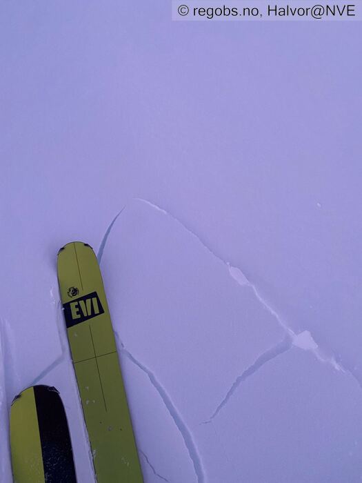
Image 1 of 6 Of: Avalanche Problems Copyright: Halvor@NVE Comment: Lett å tråkke ut mindre flak i randsonene til ferske flakdannelser. Har ikke sett segn til skytende sprekker. Kun rundt skia.
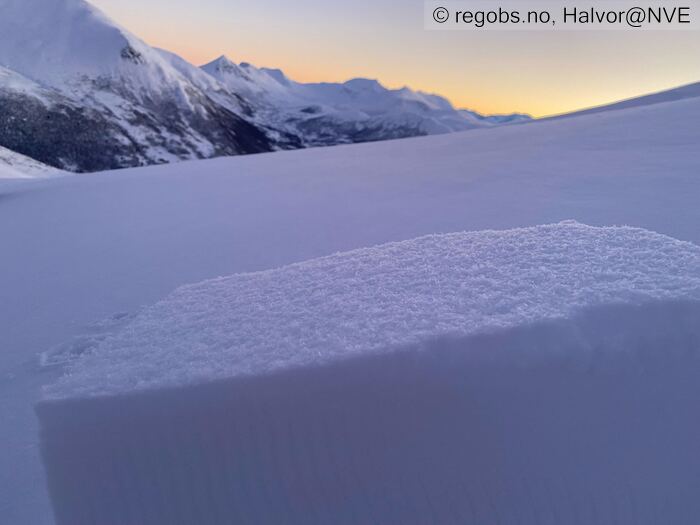
Image 2 of 6 Of: Avalanche Problems Copyright: Halvor@NVE Comment: Glatt bruddplan med begynnende kant. Men det er mange steder et tykt lag med løsere snø under som gjør at det ikke blir noe propagering.
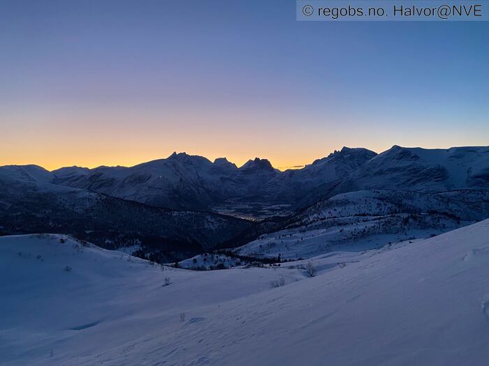
Image 3 of 6 Of: Weather Copyright: Halvor@NVE Comment: Nydelig vintervær på morgenen. Klart og kaldt. Ingen vind.
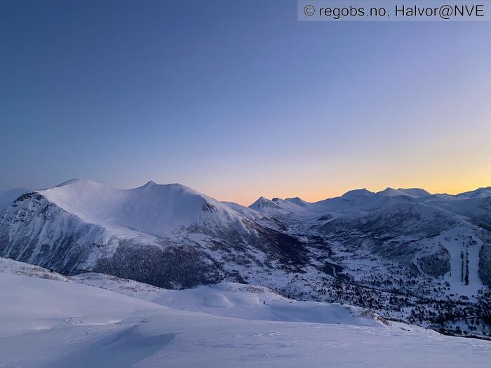
Image 4 of 6 Of: Snow Cover Copyright: Halvor@NVE Comment: Mot smørbottfjellet. Jevn snøfordelig her.
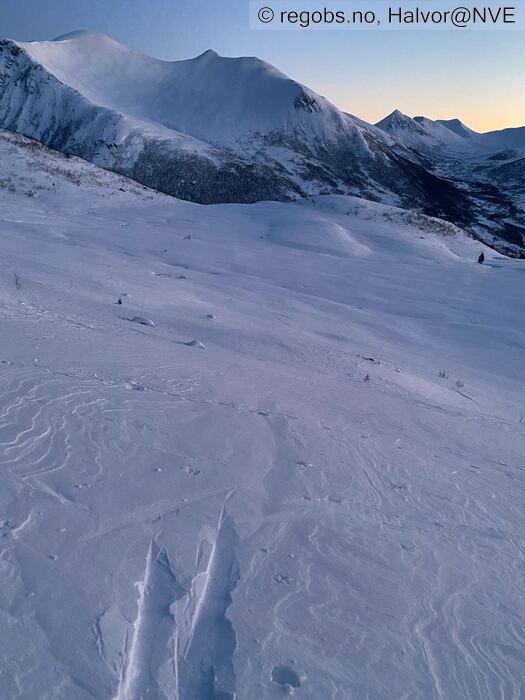
Image 5 of 6 Of: Snow Cover Copyright: Halvor@NVE Comment: Vekslende hardhet i flakene på vindutsatte plasser. Løs snø i konkave formasjoner.
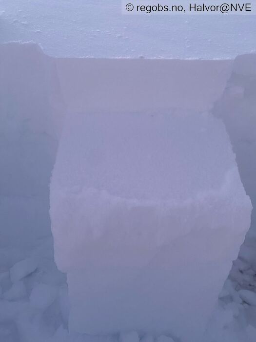
Image 6 of 6 Of: Tests Copyright: Halvor@NVE Comment: Helt rent bruddplan, men tykt lag med løsere snø under.
Fikk ikke noe brudd i smelteskaren fra sist søndag.
Weather
• Klart og kaldt. -8 på parkeringen på 350 moh. Litt mildere i høyden. Ingen vind av betydning foreløpig.
Snow Cover
• Generelle betraktninger etter noen dager på fjellet. Det har blåst kraftig på utsatte steder i noen dager nå. Mest vind i indre del av regionen og rundt romsdalen. Her har det vært føyke i flere dager. Mest i går søndag. Vindstille foreløpig i dag.
Mye snø har flyttet på seg der vinden har fått tak og det må en kraftig vindøkning eller vinddreining til for å flytte på mye mer snø.
Oppstikkende formasjoner har flakdannelser av varierende hardhet. Skjermede formasjoner har fortsatt løsning fin snø. Mye godt skiføre fortsatt.
Ved skoggrensen ligger det 50-70 cm snø jevnt over. Øverste 20-30 er løs snø som er i ferd med å kantes. Videre smelteskare med løs snø under før en er nede på gammel såle av smelteformer.
I høyden ligger det generelt 60-80 cm. I leformasjoner mye mer og på rygger litt mindre.
Under ca 1000 moh finner man mange stede igjen smelteskare fra sist søndag. Denne har varierende tykkelse og har flere steder kantkorn over og under. Jeg har enda ikke fått noen faresignal fra dette lage
Tests
• LBT@10cm(Q1) • Løsner ved frigjøring her, men likevel bare oppsprekking rundt skiene her som harde flak ligger over tykkere lag med løs snø.
Snow Profile
• NE • Persistent weak layer: below slab, near surface • 6 temperature points observed
Avalanche Problems
• Dry slab avalanche • Buried weak layer of new snow • Within half a meter • The weak layer collapses easily and clean (easy propagation). The overlying slab is soft. A big and identifiable crystal in the weak layer. • Easy to trigger • 2 - Medium • Some steep slopes N, NE, E, SE, S, SW, W, NW above 800 masl • Svakt lag er en blanding av nedføyket nysnø og begynnende kant.
Mest utsatt er vestlige og nordlige retninger etter den siste vinden, men mitt intrykk er at problemet kan finnes i alle hengertniger der vindben har fått tak.
Avalanche Danger Assessment
• Det har blåst godt fra SØ i noen dager nå. På utsatte plasser for vinden er det mye flakdannelser av varierende hardhet. Det virker som flakene stabiliserer seg relativt raskt og jeg har ikke opplevd noen faretegn de siste dagene. Det er lett å tråkke ut mindre flak i ferske flak, men har ikke funnet tegn til bruddforplantning.
Pr nå viker det som en normalsituasjon med lokal ustabilitet og Str 2 skred i få eller noen heng. • Situasjonen vedvarer i morgen før mildvær og regn onsdag gir en større endring. • 2 Moderate • Må en kraftig vindøkning til eller dreiende vind for å gi stor nok snøtransport til en økning i faregraden i dag.

