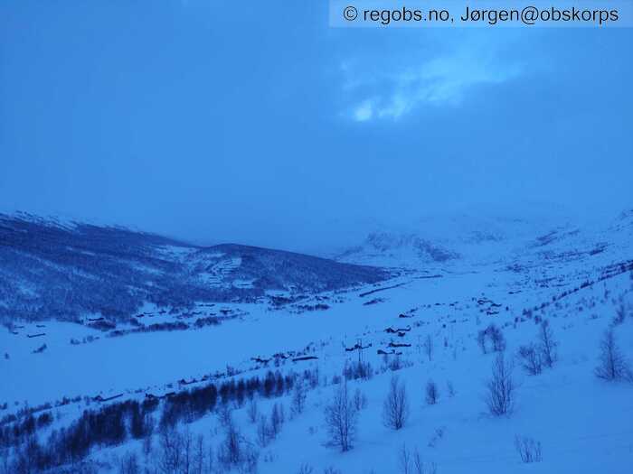
Image 1 of 7 Of: Weather Copyright: Jørgen@obskorps Comment: Mot vest.
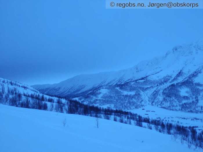
Image 2 of 7 Of: Weather Copyright: Jørgen@obskorps Comment: Mot sø
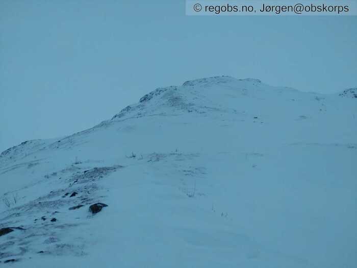
Image 3 of 7 Of: Snow Cover Copyright: Jørgen@obskorps Comment: Utsatt terrengformasjon med lite snø. Loside pekende mot sø
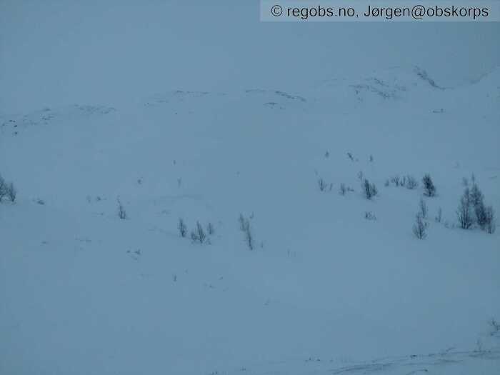
Image 4 of 7 Of: Snow Cover Copyright: Jørgen@obskorps Comment: Leside pekende mot v har mye snø.
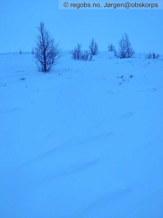
Image 5 of 7 Of: Snow Cover Copyright: Jørgen@obskorps Comment: Vindtegn etter sø vind i skoggrensa
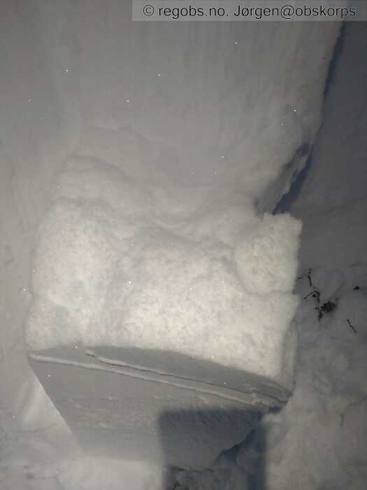
Image 6 of 7 Of: Snow Profile Copyright: Jørgen@obskorps Comment: Brudd i nysnølag i toppen av snødekket
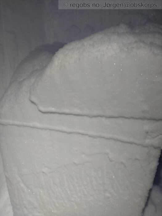
Image 7 of 7 Of: Snow Profile Copyright: Jørgen@obskorps Comment: Brudd i nysnølag lengre ned med glatt bruddflate.
Danger Sign
• Whumpf sound • Område: I denne fjellsiden. Beskrivelse: Flere drønn både vei opp og ned. Jeg er temmelig sikker på at det var kantkornlag i bånn av snødekket som kollapset. Løssnø i overflaten skjulte trolig skytende sprekker ifm drønn.
• Quick temperature change • Område: For kommunen. Beskrivelse: Temp steg i dag. Kanskje ikke raskt i den forstand at det var et faretegn, men varmere ble det.
Avalanche Activity
• 8. Jan. During the day (+01:00) • No avalanche activity • Ikke observert på fjellet eller fra bil på strekningen Hemsedal sentrum -Storeskard.
Snow Cover
• 110 cm • Some snow drift • 40 cm • Storm slab (soft slab) • Dry • Utsatte steder som rygger, topper, skar og losider mot sø i høyden er avblåst eller har lite snø. Vedr og nordvendt terreng har mange steder så mye løs snø at ferdsel er krevende både opp og ned.
Snøoverflaten er generelt myk, men påvirket av mildvær og vind mange steder. Skjerma leområder mot v og n har mye ubundet snø.
Terrenget er generelt godt fylt opp med snø og terrengformene er avrunda og utjevna.
Noen vindtegn etter vind fra s og ø her og der.
Weather
• Drizzle • -1.1 °C • 5 m/s from SE ↖ • 100% clouds • Noen regndråper i lufta som gikk over til snø mot kvelden. Generelt mildt i dag.
Ujevn vindstyrke fra 3-8 m/s med kast som flytta litt snø.
• ECTP15@55cm(Q2) • Poor • Dette var på grensa til Q1 brudd.
• ECTP15@90cm(Q3) • Poor • Kom samtidig som brudd i nysnøkrystaller i svakt lag lengre opp.
Snow Profile
• NW • Persistent weak layer: thin layer, below slab • 8 temperature points observed
Avalanche Problems
• Dry slab avalanche • Buried weak layer of new snow • Within half a meter • The weak layer collapses easily and clean (easy propagation). The collapsing weak layer is thin < 3 cm. The overlying slab is soft. A big and identifiable crystal in the weak layer. • Easy to trigger • 2 - Medium • Some steep slopes N, SW, W, NW above 900 masl • Skredstr begrenses av flakets hardhet.
• Dry slab avalanche • Buried weak layer of faceted snow near the ground • Within a meter • The overlying slab is soft. A big and identifiable crystal in the weak layer. • Easy to trigger • 3 - Large • Few steep slopes N, NE, E, SE, S, SW, W, NW above 900 masl • Kan være lett få steder , eller vanskelig noen steder. Jeg tenker dette sp skal generelt mer til for å påvirke nå , men enkelte steder kan en enkelt skiløper gjøre det og da vil det være fare for store skred.
Avalanche Danger Assessment
• Generelt ustabilt snødekke med to tydelige skredproblem. Faretegn som drønn og sprekker i snødekket. Fakdsnnelse i toppen av snødekket nå gjør at det er lett til svært lett å løse ut skred med svakt lag som nysnøkrystaller. Det er kaldt nede i snøen og nysnøkrystaller er intakte. Skredstr vil foreløpig bli begrenset av relativt mjuke flak i toppen.
Kantkorn ved bakken vil kunne påvirkes færre steder, men må i høyeste grad tas med i betraktning og er et potent skredproblem. • Mye vær meldt fremdeles og enden på denne visa er ikke lett å si noe om enda. Mange variabler med temp, vind og ytterligere nedbør gjør at situasjonen er kompleks og uavklart. Kort sagt har det og vil være skredvær. • 3 Considerable • Forecast correct

