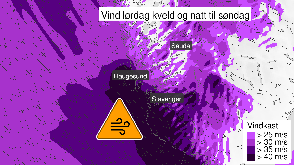
Warning from MET Norway for Rogaland
3
Very strong wind gusts, orange level (MET)
Published:
Valid:
from 29.01.2022 16:00
to 30.01.2022 07:00
Warning
Wind gusts
-
Sender: MET Norway
-
Danger ongoing: Saturday, January 29, 2022, kl.4:00 PM
-
Danger decrease: Sunday, January 30, 2022, kl. 7:00 AM
-
Certainty: Likely > 50%
Consequence
Larger loose items may be taken by the wind. Risk of damage to buildings and infrastructure. Cancelled departures for ferry, plane, or other transport expected. Bridges may be closed. Many journeys may have longer travel times. The power supply will be impacted, due to tree(s) falling over. Roads may be closed due to trees or other objects in the road. Blowing snow at higher altitudes causes reduced visibility and possibly convoys and/or closed roads. High waves may cause damage to infrastructure and buildings in the coastal zone. The strong wind may cause locally high waves in fjords and lakes.
Advice
Secure all loose objects. Avoid exposed places. Allow a lot of extra time for transportation and driving. Consider whether the journey is necessary. Follow advice and check status from transport operators. Check road reports (175.no). The need for emergency preparedness shall be assessed continuously by emergency response actors. Be careful in coastal areas. In advance consider measures to limit damage.
Description
Saturday evening it is expected northwest storm force 10 with locally severe wind gusts of 35-42 m/s. The strongest wind is expected at the coast and In mountain areas. The wind decreases Sunday morning.