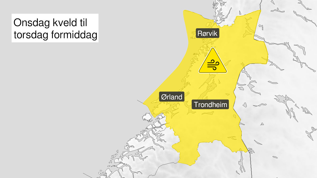
Warning from MET Norway for Trøndelag
2
Strong wind gusts, yellow level (MET)
Published:
Valid:
from 19.01.2022 19:00
to 20.01.2022 12:00
Warning
Wind gusts
-
Sender: MET Norway
-
Danger ongoing: Wednesday, January 19, 2022, kl.7:00 PM
-
Danger decrease: Thursday, January 20, 2022, kl. 12:00 PM
-
Certainty: Likely > 50%
Consequence
Loose items may be taken by the wind. Possibly cancelled departures for ferry, plane, or other transport. Bridges may be closed. Some journeys may have longer travel times. The power supply may be impacted, due to tree(s) falling over. Some roads may be closed due to trees or other objects in the road. Blowing snow causes reduced visibility and possibly convoys and/or closed roads. High waves may cause damage to infrastructure and buildings in the coastal zone. The strong wind may cause locally high waves in fjords and lakes.
Advice
Secure loose objects. Avoid unnecessary journeys to exposed places. Follow advice and check status from transport operators. Check road reports (175.no). Be careful in coastal areas. In advance consider measures to limit damage.
Description
From Wednesday evening strong wind gusts from west and northwest are expected, locally 27-35 m/s, strongest wind gusts at the coast. The wind decreases Thursday forenoon.