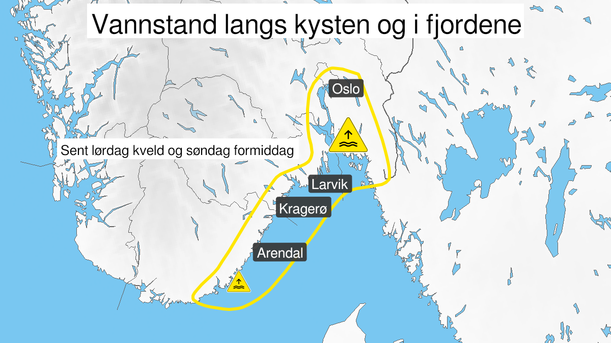
Warning from MET Norway for Agder, Telemark og Buskerud, Vestfold, Østfold og Oslo
2
High water level, yellow level (MET)
Published:
Valid:
from 21.11.2020 23:00
to 22.11.2020 13:00
Warning
Water level at the coast and in the fjords
-
Sender: MET Norway
-
Danger ongoing: Saturday, November 21, 2020, kl.11:00 PM
-
Danger decrease: Sunday, November 22, 2020, kl. 1:00 PM
-
Certainty: Likely > 50%
Consequence
Local flooding and risk of minor damage to infrastructure and buildings in the beach zone.
Advice
Check the mooring of the boat and secure objects near the water in the coastal zone.
Description
Forecast for route Viker to Tregde: Late Saturday evening, early Sunday morning and late Sunday morning high water levels are expected. More information regarding time for high water levels and values for places along the coast can be found at sehavniva.no. The uncertainty in forecasted water level is 5-10 cm.