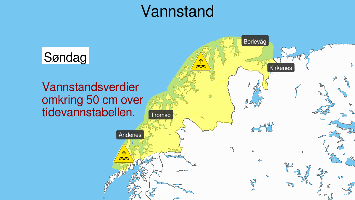
Warning from MET Norway for Vesteraalen and Troms and Vest-Finnmark med Vidda and Kyst- and fjordstroekene i Oest-Finnmark
2
High water level, yellow level (MET)
Published:
Valid:
from 12.01.2020 12:00
to 12.01.2020 19:00
Warning
Water level at the coast and in the fjords
-
Sender: MET Norway
-
Danger ongoing: Sunday, January 12, 2020, kl.12:00 PM
-
Danger decrease: Sunday, January 12, 2020, kl. 7:00 PM
-
Certainty: Likely > 50%
Consequence
Local flooding and risk of minor damage to infrastructure and buildings in the beach zone.
Advice
Check the mooring of the boat and secure objects near the water in the coastal zone.
Description
Forecast for route Vesterålen to Grense Jakobselv: Sunday high water level is expected, estimated to around 50 cm above the height given in the tide tables. The water level is expected to be at its highest Sunday between 13 and 18 o"clock, earliest in the southern part. More information about tides and water level at sehavniva.no