Warning from MET Norway for Agder and parts of Telemark
3
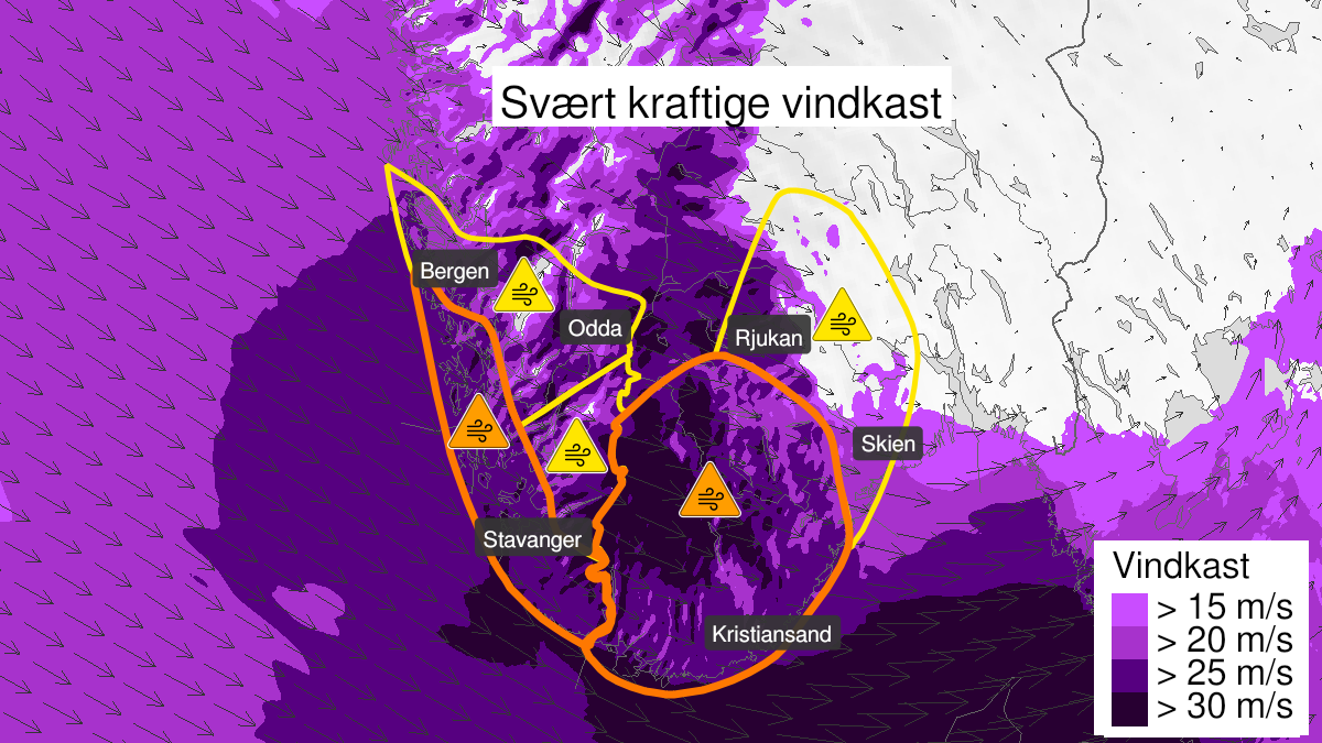
Very strong wind gusts, orange level (MET)
Published:
Valid:
from 17.02.2023 14:00
to 18.02.2023 00:00
Warning
Wind gusts
-
Sender: MET Norway
-
Danger ongoing: Friday, February 17, 2023, kl.2:00 PM
-
Danger decrease: Saturday, February 18, 2023, kl. 12:00 AM
-
Certainty: Likely > 50%
Consequence
Larger loose items may be taken by the wind. Risk of damage to buildings and infrastructure. Cancelled departures for ferry, plane, or other transport expected. Bridges may be closed. Many journeys may have longer travel times. The power supply will be impacted, due to tree(s) falling over. Roads may be closed due to trees or other objects in the road. High waves may cause damage to infrastructure and buildings in the coastal zone.
Advice
Secure all loose objects. Avoid exposed places. Allow a lot of extra time for transportation and driving. Consider whether the journey is necessary. Follow advice and check status from transport operators. Check road reports (175.no). The need for emergency preparedness shall be assessed continuously by emergency response actors. Be careful in coastal areas. In advance consider measures to limit damage.
Description
Locally very strong wind gusts are expected around 25 m/s, at the coast up to 40 m/s, from west and later northwest. The wind will increase first in western parts of Agder, and will gradually decrease from late in the evening Friday.