Map of avalanche terrain now available on the Varsom app
The Varsom app, now with a map of avalanche terrain for tour planning.
The Norwegian Avalanche Warning Service released a new version of the Varsom app for Easter 2020. The new version includes a a map of avalanche terrain in Norway.
- The map is a great aid for tour planning – for ski touring, snow mobiling or other types of backcountry trips, according to Håvard Toft Larsen, avalanche forecaster at NVE.
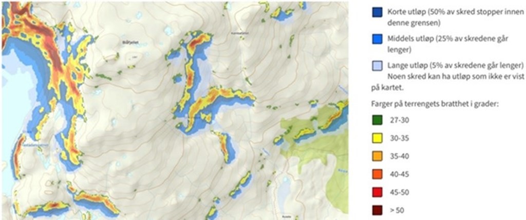
Avalanches may release in snow covered terrain steeper than 30 degrees. It’s important to identify where avalanches could release and how far they could reach, in order to assess how avalanche-exposed different tours may be.
The new maps in the mobile app will help backcountry users to recognize both release areas and runout zones.
Download the latest version of the Varsom app on App Store or Google Play.