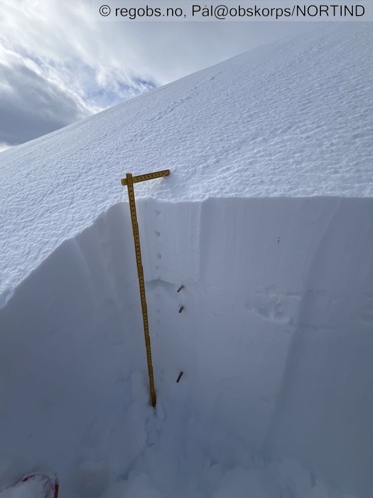
Image 1 of 15 Of: Snow Profile Copyright: Pål@obskorps/NORTIND
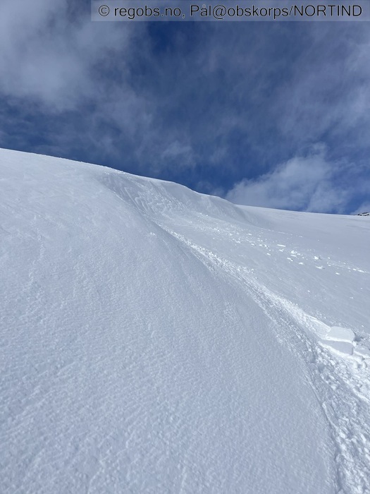
Image 2 of 15 Of: Snow Cover Copyright: Pål@obskorps/NORTIND Comment: Ikke mulig få ut noe annet enn klumper i denne formasjonen. (Rett ved profil og tester) Hard fokksnø.
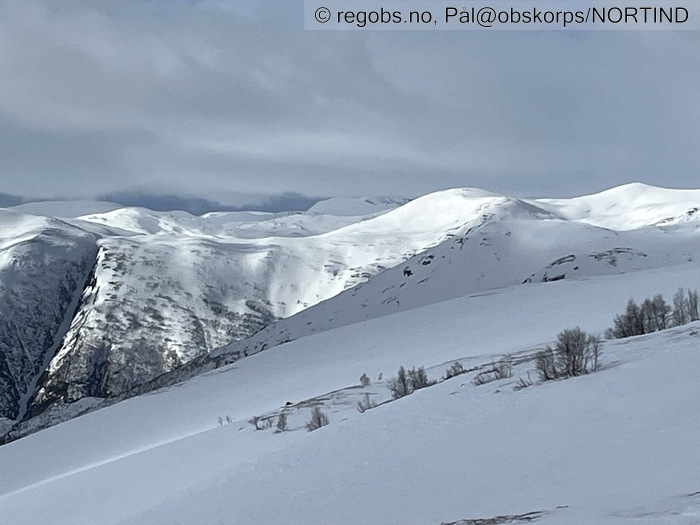
Image 3 of 15 Of: Weather Copyright: Pål@obskorps/NORTIND
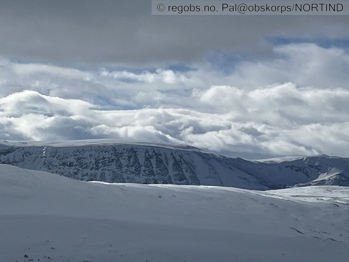
Image 4 of 15 Of: Weather Copyright: Pål@obskorps/NORTIND
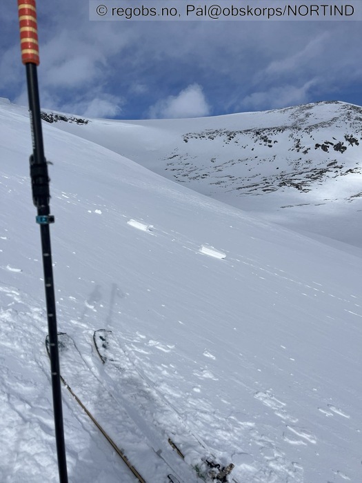
Image 5 of 15 Of: Snow Cover Copyright: Pål@obskorps/NORTIND Comment: Kun blokker/klumper som sklir
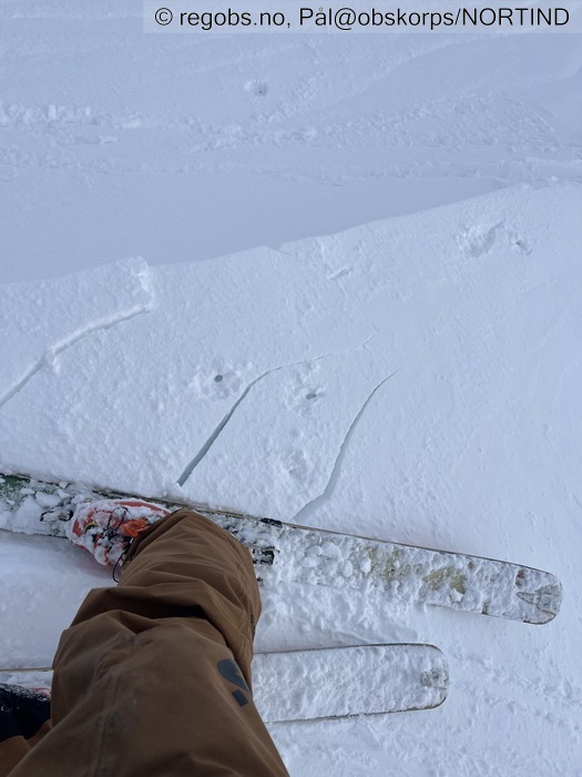
Image 6 of 15 Of: Snow Cover Copyright: Pål@obskorps/NORTIND Comment: Sprekker noe på toppen av formasjon med ikke forplantning
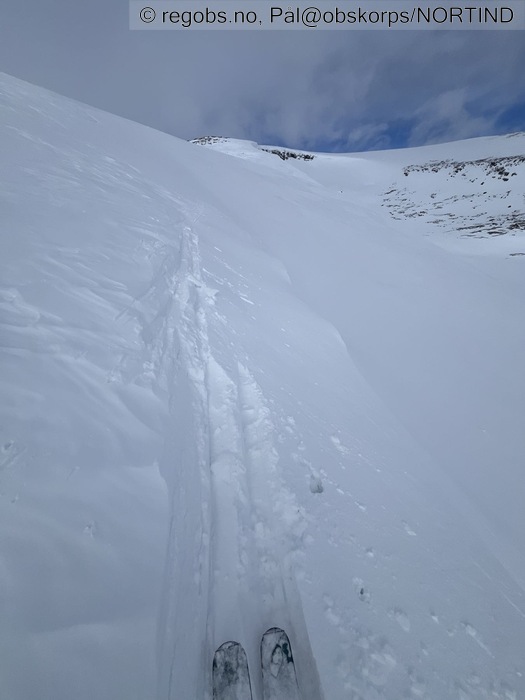
Image 7 of 15 Of: Snow Cover Copyright: Pål@obskorps/NORTIND Comment: Skjer null her.
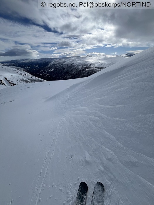
Image 8 of 15 Of: Snow Cover Copyright: Pål@obskorps/NORTIND Comment: Bærende relativt fersk fokksnø
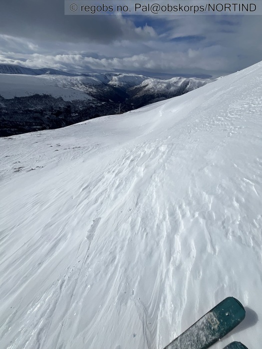
Image 9 of 15 Of: Snow Cover Copyright: Pål@obskorps/NORTIND Comment: Hard eldre fokksnø
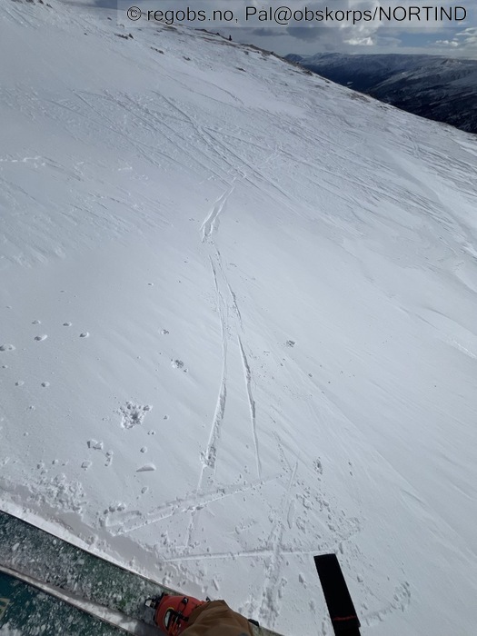
Image 10 of 15 Of: Snow Cover Copyright: Pål@obskorps/NORTIND Comment: Fersk fokksnø
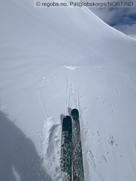
Image 11 of 15 Of: Snow Cover Copyright: Pål@obskorps/NORTIND Comment: Bratt formasjon med fersk fokksnø
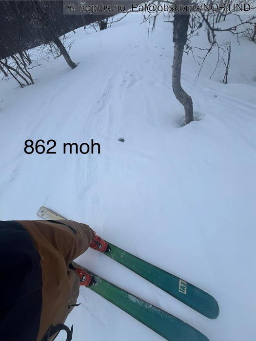
Image 12 of 15 Of: Snow Cover Copyright: Pål@obskorps/NORTIND Comment: Fra 862 mih er det bitte litt nysnø. Fuktig her som kladder på feller
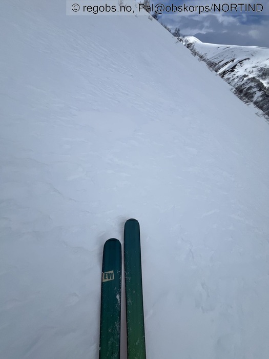
Image 13 of 15 Of: Snow Cover Copyright: Pål@obskorps/NORTIND Comment: Hard skare mot s rett over skoggrensa. Grovkornet og gir godt feste oppover
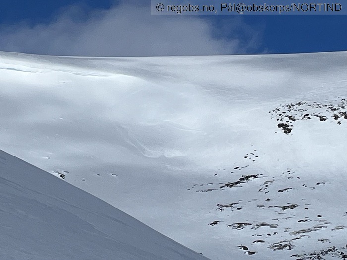
Image 14 of 15 Of: Avalanche Activity Copyright: Pål@obskorps/NORTIND Comment: Str 1 fra helga.
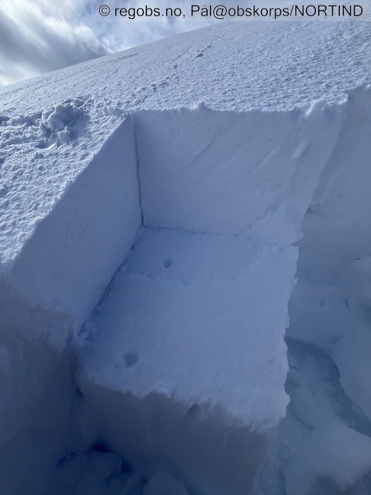
Image 15 of 15 Of: Tests Copyright: Pål@obskorps/NORTIND Comment: Nedtrappende brukk på LBT
Avalanche Activity
• 22. Mar. During the day (+01:00) • No avalanche activity • Ikke noe ferskt å se. Kan se bruddkant fra søndag. Helt klart str 1 som meldt inn
Weather
• No precipitation • -0.9 °C • 7 m/s from SW ↗ • 69% clouds • Mildt vær. 6 grader på parkeringa. Kald vind i høgden kjøler snødekke. Mildt i dag tidlig på 630 moh
Snow Cover
• 150 cm • No snowdrift • 2 cm • Elevation of new snow 850 masl. Snow line at 300 masl • Some loose snow (1-10cm) • Dry • Ok • Under 1000 moh er snødekke preget av nye skare og hard vindpåvirket snø. Det kom på et tynt lag med nysnø i går, fra 862 moh her. Det kladder på feller et godt stykke opp, fuktig. Eldre snø er grovkornet her og gir godt feste til å gå på. Fra 900 moh og ned er det varmt nok til at snøen blir noe mjuk også i slakt terreng. Fra parkeringa er det fuktig snø fra morgenen
Det er mulig å kjøre mjuk snø til fjells i fersk fokksnø, solvarma mjuk snø i bratt sør og mjuk snø i lavlandet hvor det er varmt.
Tests
• LBT@23cm(Q3) • Bryter ut i små blokker, men på LBT gir er bruddet Q3 og ikke lett.
• ECTN24@23cm(Q3) • Good • Med spaden bak så kommer hele blokka med en gang. Ved mjukere flak er det nok fortsatt mulig å få P brudd, men ikke noe skjer med hopping med ski i formasjonen
Snow Profile
• NE • 1 test connected to snow profile • Temp gradient borte ved kantkorn lag her nå • Persistent weak layer: below slab, near surface • 5 temperature points observed
Avalanche Problems
• Dry slab avalanche • Buried weak layer of faceted snow near surface • Within half a meter • A big and identifiable crystal in the weak layer. • Difficult to trigger • 1 - Small • Few steep slopes N, NE, E, SE, S, NW above 1000 masl • Mulig det går an å løse ut det det evt er mjuke flak fortsatt. Vær også obs på varme rundt dette.
Avalanche Danger Assessment
• Noe nysnø har stedvis lagt igjen mjuk snø til fjells. Mildt vær stabiliserer fokksnø relativt raskt. Vedvarende svakt lag som finnes enkelte steder opprettholder skredfaren men i store områder er det mye terreng med hard snøoverflate og skredfaren er liten. Utglidningsfaren på hardt underlag er verdt å huske på når en ferdes i fjellet nå
Vær obs på at der det er varmt og at der snødekke blir vått er det mulig å løse ut våte skred. • Varmt vær og sol kan føre til våte skred. Også naturlig utløst. Vær obs på skavler og når en ferdes under disse. • 1 Low • Forecast correct

