Classified avalanche terrain in Norway
Terrain and tour classification makes it easier to select safer trips and routes.
ATES - Avalanche Terrain Exposure Scale (in Norwegian KAST) divides the terrain in 5 terrain classes. Determine which terrain is suitable for you and your group on the given day. The goal is to prevent avalanche accidents.
Choose easier terrain if the avalanche risk is high or if the group has little experience traveling in avalanche terrain. Even in simple terrain, avalanche terrain exists, but it is also easy to avoid it.
Classified skitours
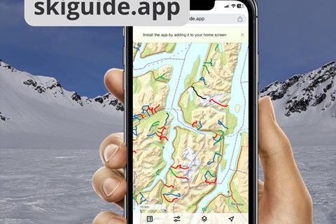
The project "Nullvisjon Skredulykker" has released the website skiguide.app, developed by our partners in CARE - Center for Avalanche Research and Education and TrailguideApp.
In skiguide.app, many well-known ski tours in Tromsø, Lyngen, Senja, Loftoen and Vesterålen are described, quality checked and avalanche classified. The best route is drawn and the tour is classified according to the ATES -classification. You'll also will also find the avalanche warnings and the steepness maps in the description.
The website is part of the "Nullvisjon Skredulykker"-project, where the tourism industry in Troms, the Police in Troms, CARE - Center for Avalanche Research and Education and Varsom - the Norwegian avalanche warning service collaborates with the aim to reduce accidents in the mountains.