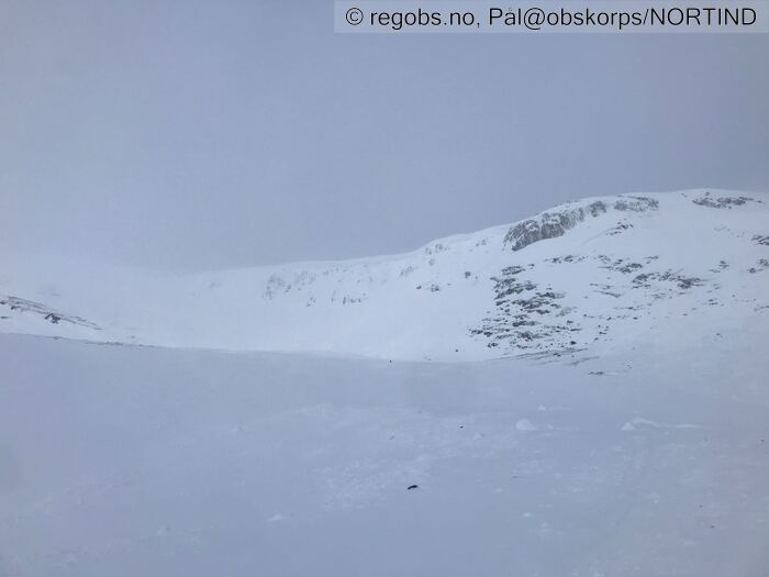
Image 1 of 6 Of: Avalanche Activity Copyright: Pål@obskorps/NORTIND Comment: Aktivitet inne i botnen på Storhaugen. Store skavler. Noe har gått seint i går.
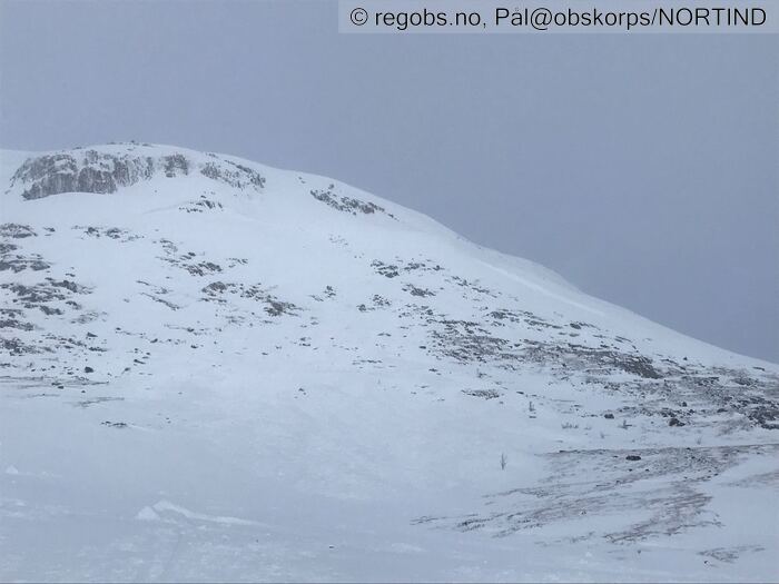
Image 2 of 6 Of: Avalanche Activity Copyright: Pål@obskorps/NORTIND Comment: Bruddkant på ca 150 meter kanskje. str 3
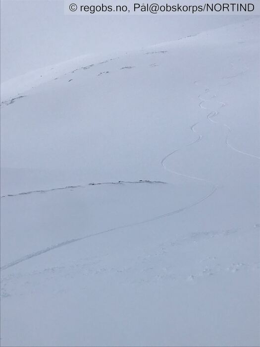
Image 3 of 6 Of: Snow Cover Copyright: Pål@obskorps/NORTIND
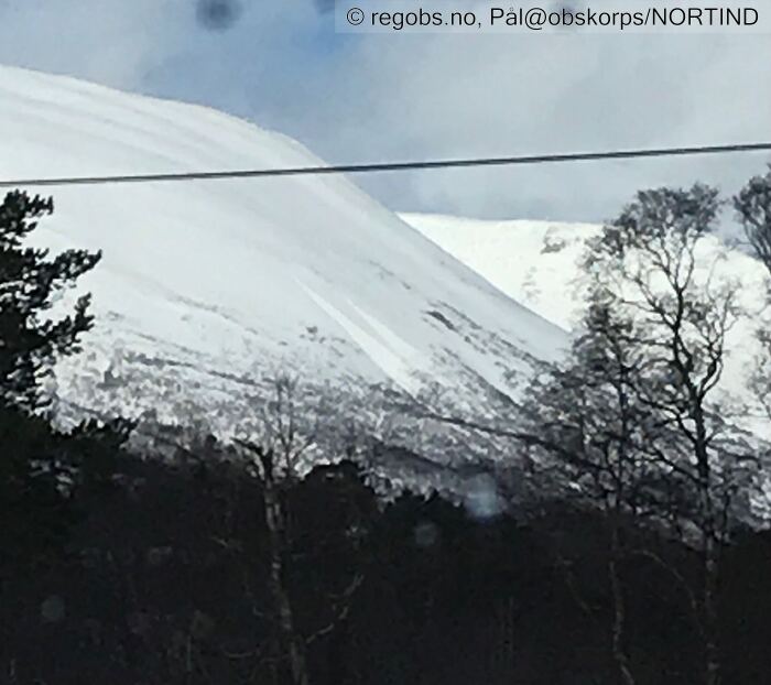
Image 4 of 6 Of: Avalanche Activity Copyright: Pål@obskorps/NORTIND Comment: 2 Våte løssnøskred på Gjerdhøa mens jeg var på tur.
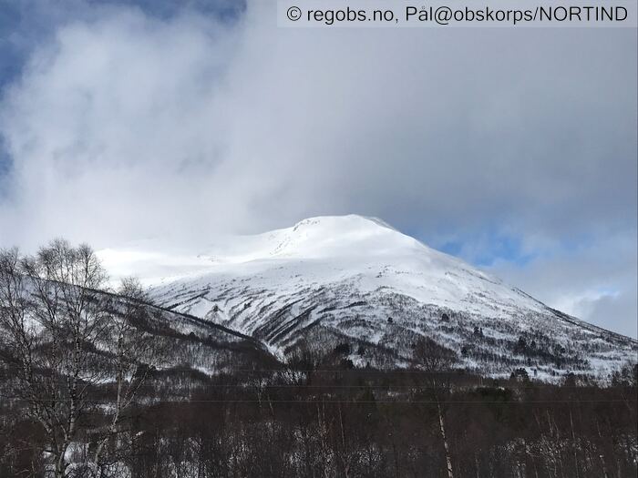
Image 5 of 6 Of: Weather Copyright: Pål@obskorps/NORTIND
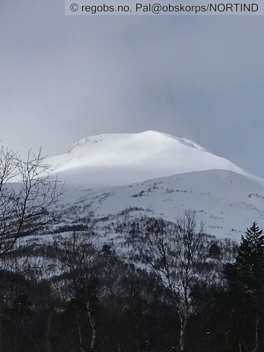
Image 6 of 6 Of: Snow Cover Copyright: Pål@obskorps/NORTIND
Danger Sign
• Recent avalanches • Våte løssnøskred str 2 i løpet av formiddagen
Avalanche Activity
• 22. Mar. 6-12 (+01:00) • Dry slab avalanche • Few (2-5). 3 - Large. Spontaneous release • Some steep slopes. E, SE, S. Above 1200 masl • Bruddkanter fra været stod på i går med snø og vind. Mest sannsynlig fra i går ettermiddag/kveld. Inne i botnen øst for Storhaugen.
• 22. Mar. 0-6 (+01:00) • Loose wet avalanche • Few (2-5). 2 - Medium. Spontaneous release • Some steep slopes. E, SE, S, SW. Below 1100 masl
• 22. Mar. 0-6 (+01:00) • No avalanche activity • skavlbrudd. Ser ferske skavlbrudd fra Ryggen ml Storhornet og Elghøa. 13:00. Str 1
Weather
• No precipitation • -1.1 °C • 7 m/s from W → • 90% clouds • I går kveld var det skikkelig snøvær og vind. La seg opp store mengder snø i leheng. Vasa oppover i fjellet med stedvis 50 cm nysnø i øvre dele av skogen. Vind videre utover kveld/natt i går. Rolig på 740 moh i dag tidlig 06:00. Overskyet og 1,5 plussgrad.
Snow Cover
• 190 cm • Some snow drift • 20 cm • Some loose snow (1-10cm) • Moist • Lett snøfokk over 1000 moh. Våt, tung snø opp til ca 900. Flott skiføre fra 1300 moh og ned til 900. Der ble det brått stopp i sugeføre og våt, tung snø. Terrenget ser mer og mer "normalt" ut med tanke på snømengde. I går kveld var det meget tydelig skredproblem med nedføyka svakt lag med nysnø. Ikke drønn eller sprekker i går kveld heller. Mildt vær har stabilisert snødekket siden i går. Det er stedvis store overhengende skavler. Disse kan komme ned nå ved varmt vær og evt sol.
• LBT@40cm(Q2) • Mot skare. Skal en ordentlig belastning til her
• ECTN26(Q3) • Good • Snøen blir i all hovedsak kun sammentrykt under spaden. Ikke tegn til bruddforplantning.
Snow Profile
• 6 Stratigraphy layers • 7 temperature points observed
Avalanche Problems
• Dry slab avalanche • Buried weak layer of new snow • Within half a meter • The overlying slab is soft. A big and identifiable crystal in the weak layer. • Easy to trigger • 2 - Medium • Some steep slopes NE, E, SE, S, SW above 1000 masl • Lagt seg opp ganske store mengder snø siden lørdag. mildt vær stabiliserer fokksnøen relativt raskt.
• Loose wet avalanche • Loose snow • Spontaneous release • 2 - Medium • Some steep slopes E, SE, S, SW above 600 masl • Vært og er aktivitet i våte løssnøskred. Vær obs når varmen går høgt til store skavler etter siste snøfall.
Avalanche Danger Assessment
• Påfyll av snø og sterk vind fra vest har flytta snø inn i østvendte leformasjonar. I bratte heng med fersk fokksnø kan det fortsatt være lett for en skiløper å løse ut skred. Spesielt høgt til fjells hvor varmen ikke har fått virke ennå. Vær obs der snødekket er eller blir vått, der kan det gå våte løssnø skred. Det er store skavler til fjells så vær også obs på at disse kan gå ved varme og eller sol. Høgt til fjells spesielt i nordlige sektorer finnes det fortsatt vedvarende svakt lag med kantkorn som kan påvirkes, spesielt ved tynt eller mjukt snødekke. • Varmt vær stabilisere fokksnøen. Varmen vil gradvis gå høgere i morgen. • 2 Moderate • Forecast correct • Fint å ligge på FG3 til og med i dag i Trollheimen. Naturlig utløst kunne vært med i dag (våte løssnøskred, og tørre flak i går)

