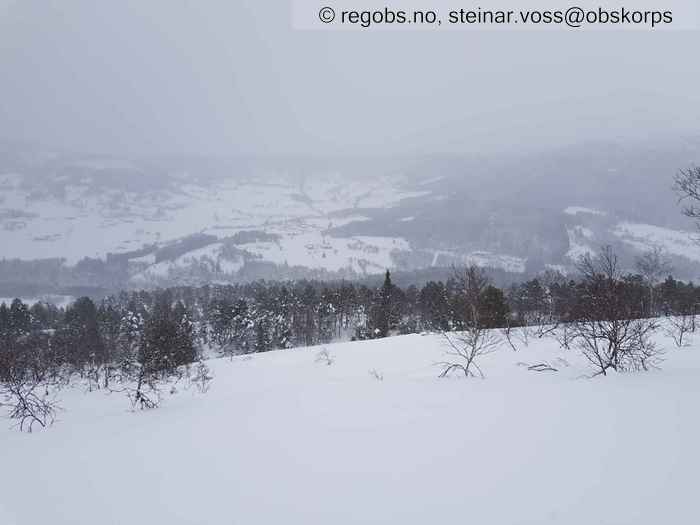
Image 1 of 9 Of: Snow Cover Copyright: steinar.voss@obskorps Comment: Bilde tatt nedover dalsiden fra 650 moh. Den lause snøen på træra er blåst av. Frosne chuncks henger enda på en del steder.
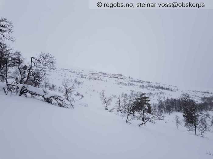
Image 2 of 9 Of: Snow Cover Copyright: steinar.voss@obskorps Comment: Bilde tatt oppover dalsiden fra 650 moh. Ikke snø på trærne. På konvekser er snødekket vindpakka mykt.
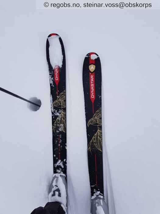
Image 3 of 9 Of: Snow Cover Copyright: steinar.voss@obskorps Comment: 700 moh, konveks mot nordøst: såvidt bærende fokksnø, selv med smale ski. Staven presses lett gjennom, og det er tydelig løsere snø under.
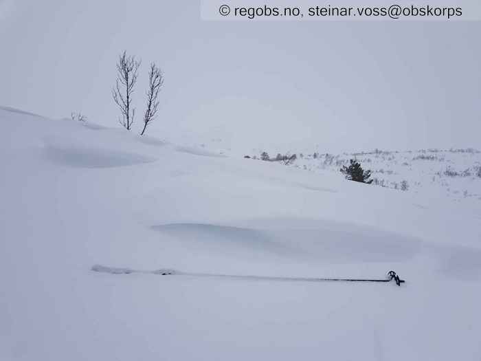
Image 4 of 9 Of: Snow Cover Copyright: steinar.voss@obskorps Comment: En konveks, 750 moh. Trinsa peiker mot nordvest. Tydeligste vindtegn i snøen her. Utfresning i lo.
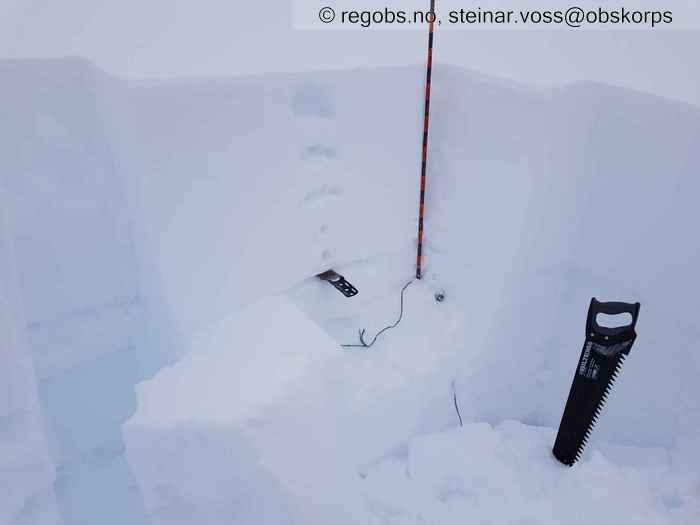
Image 5 of 9 Of: Snow Profile Copyright: steinar.voss@obskorps Comment: 770 moh. NØ leside. Representativ for det meste av NØ-vendt terreng rundt tregregrensa. Ubunden snø (F) øverst, med sukksessivt mer bunden, finkorna snø nedover mot øverste skarelag (saga, trolig juleskaren, men blei litt usikker.). Under saga er det storkorna snø, med rester av gamle skarelag.
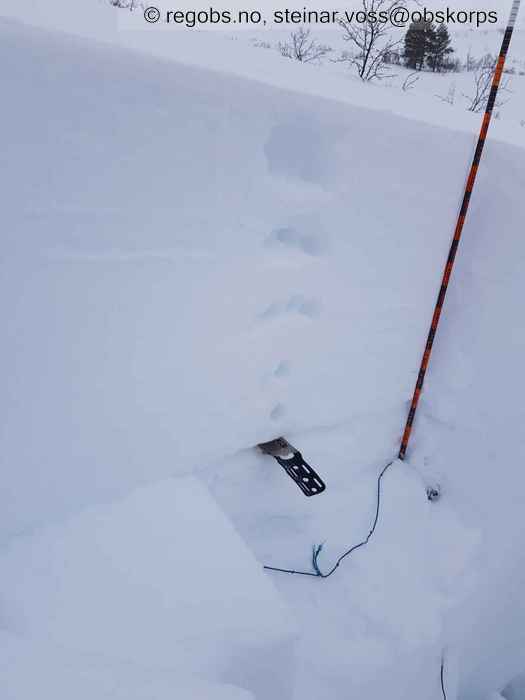
Image 6 of 9 Of: Snow Profile Copyright: steinar.voss@obskorps Comment: Nærbilde av bruddflate CTM15@55, Q3 på kantkornlag like over skarelag. EXTX.
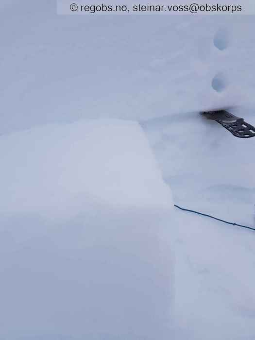
Image 7 of 9 Of: Snow Profile Copyright: steinar.voss@obskorps Comment: Q3 bruddflate på kant over skarelag. Den overliggende gamle fokksnøen er 1F hard.
Image 8 of 9 Of: Snow Profile Copyright: steinar.voss@obskorps Comment: Viser ikke så bra, men forsøkt avbildet er lagpakka fra øvre skarelag og ned til bakken. Det er storkorna snø, med 3-4 eldre skarelag. Det gamle snødekket er kompakt og sterkt.
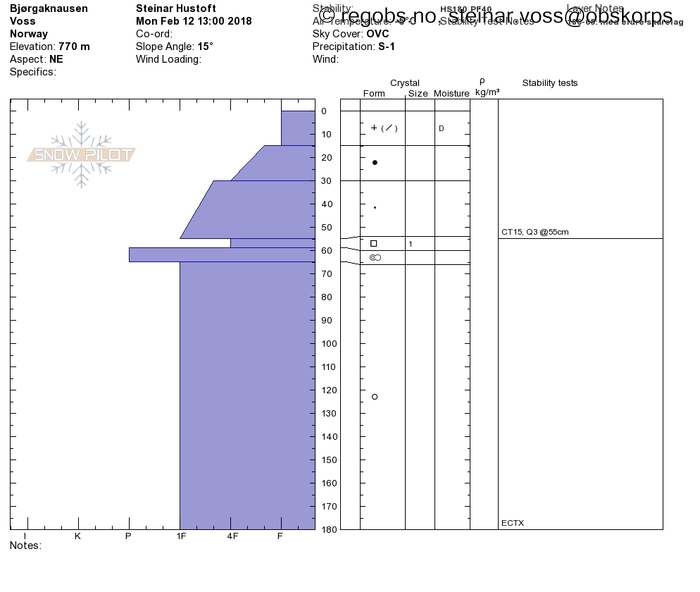
Image 9 of 9 Of: Snow Profile Copyright: Comment: Samme profil som vist i bildene her. 770 moh. NØ. Merk at det er dårlig utvikla kantkorn (burde kanskje vært definert som en overgangsform istedet for clean FC).
Danger Sign
• Recent snowdrift • Fra i går. Store skavler i lesider i nordlig sektor. Skred og trolig også skavlbrudd, men de er nok ikke fra i dag.
Weather
• Snow • -4.9 °C • 1 m/s from NW ↘ • 100% clouds • Har ikke vært på Voss i helga, så har ikke detaljene på været. Men det har blåst heftig i høyden i går.Og Vikafjellet er fortsatt stengt.
Snow Cover
• 180 cm • No snowdrift • 4 cm • Very much loose snow (>30cm) • Dry • Det er kommet 3-4 cm tørr nysnø i natt, som snø også nede i bygda. Snødekket opp til ca 500 moh har vært gjennom et kortvarig mildvær, nå påfryst, og med litt nysnø fra i natt på toppen. Man tråkker gjennom skarelaget her, og det er tørrsnø under.
Mye ubunden snø i øvre del av skogen, men den begynner å sige litt sammen. Når man stikker hodet ut av skogen, så er overflata vindpakka myk på alle kuler. Litt høyere er det utfresninger. I lesidene (NV, N, NØ) er det mulig å finne fin skikjøring i renner og søkk.
Over tregrensa kunne jeg i morges se fra stua at knauser og rygger var helt avblåst. Det ligger store skavler i nordvendte lesider. Har ikke sett det på nært hold, men regner med at det snøoverflaten vil veklse mellom svært stive flak til mjuke flak i høyfjellet.
• CTM14@55cm(Q3) • Good • Brudd på kant, over øverste skarelag. Tror det er juleskaren.
Avalanche Problems
• Dry slab avalanche • Buried weak layer of new snow • Within half a meter • Easy to trigger • Possible • 3 - Large • Some steep slopes N, NE, E, W, NW above 600 masl • Skredproblemet har mindre utbredelse (i himmelretning) i høyfjellet.
Avalanche Danger Assessment
• Det er mye innblåst fokksnø i leheng vendt mot nord og nordvest (fra i går), som vil trenge tid til å stabilisere seg. Har ikke fått faretegn i dag, men så har jeg bare vært i øvre del av tregrensa. Snudde ved 770 moh. pga dårlig sikt. Snødekket i høyden bærer tydelig preg av sterk vind. Det er heftige skavler mot nordlig sektor og jeg kan se mange blokkavsetninger i bunn av brattheng. Usikker på om det er skavlbrudd eller om flere av de er bruddkanter av flakskred (kun sett med kikkert).
Kantkornlaget over juleskaren er ikke potent ved 770 moh, tjukt snødekke (180cm HS). • Rolig vær i vente, så forventer ikke noen fornying av skredproblemene. • 3 Considerable • Er det ikke ulogisk at et fokksnøproblem bare finnes i noen bratte heng, når nesten hele eksposisjonsdiagrammet er brukt?

