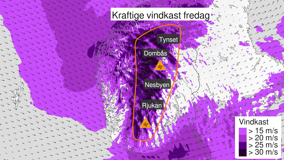
Warning from MET Norway for Vest-Agder, Aust-Agder, Telemark, Buskerud, Oppland and Hedmark
3
Very strong wind gusts, orange level (MET)
Published:
Valid:
from 19.11.2021 07:00
to 19.11.2021 21:00
Warning
Wind gusts
-
Sender: MET Norway
-
Danger ongoing: Friday, November 19, 2021, kl.7:00 AM
-
Danger decrease: Friday, November 19, 2021, kl. 9:00 PM
-
Certainty: Likely > 50%
Consequence
Larger loose items may be taken by the wind. Risk of damage to buildings and infrastructure. Cancelled departures for ferry, plane, or other transport expected. Many journeys may have longer travel times. The power supply will be impacted, due to tree(s) falling over. Roads may be closed due to trees or other objects in the road. Blowing snow at higher altitudes causes reduced visibility and possibly convoys and/or closed roads.
Advice
Secure all loose objects. Avoid exposed places. Allow a lot of extra time for transportation and driving. Consider whether the journey is necessary. Check road reports (175.no). The need for emergency preparedness shall be assessed continuously by emergency response actors. In advance consider measures to limit damage.
Description
From Friday morning locally strong wind gust is expected from west and northwest, 25-30 m/s. Stronger wind in the mountain. Strongest gust is expected Friday afternoon and the wind will decrease during Friday evening.