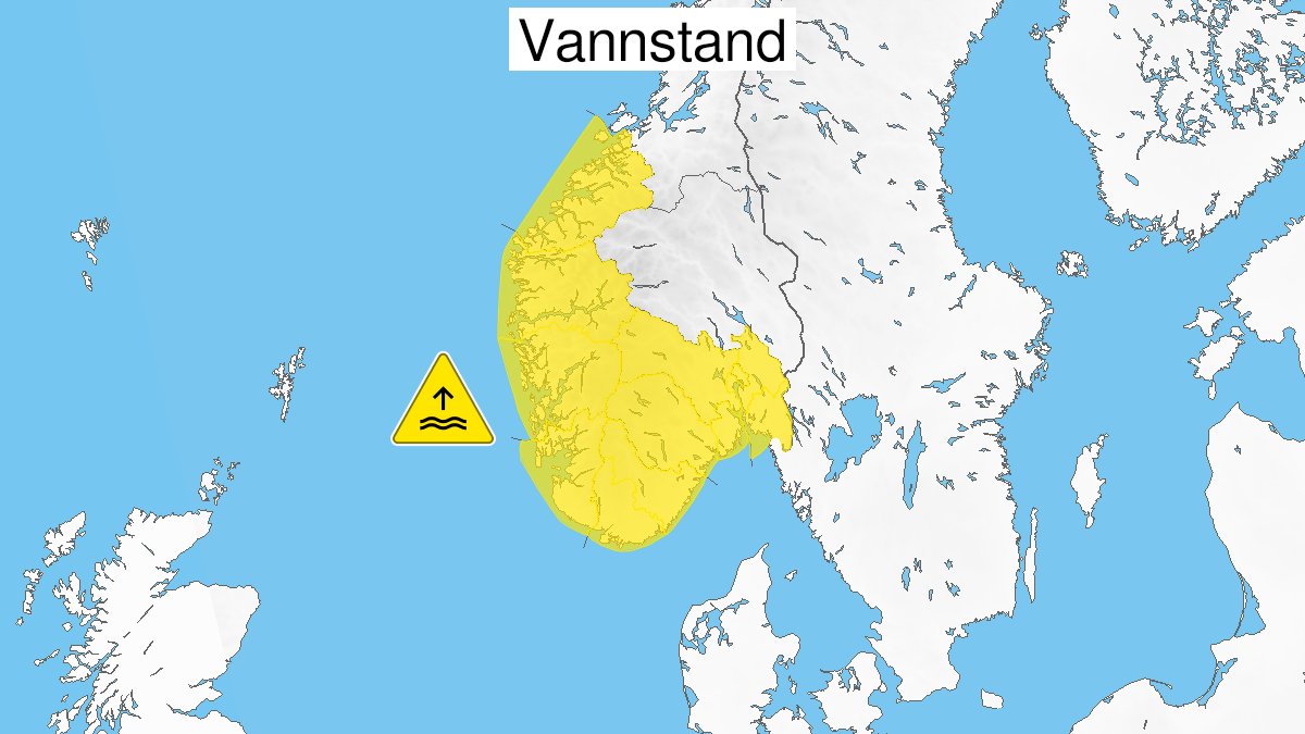
Warning from MET Norway for Vestlandet
2
High water level, yellow level (MET)
Published:
Valid:
from 01.11.2020 22:00
to 02.11.2020 14:00
Warning
Water level at the coast and in the fjords
-
Sender: MET Norway
-
Danger ongoing: Sunday, November 1, 2020, kl.10:00 PM
-
Danger decrease: Monday, November 2, 2020, kl. 2:00 PM
-
Certainty: Likely > 50%
Consequence
Local flooding and risk of minor damage to infrastructure and buildings in the beach zone.
Advice
Be careful in coastal areas. Check the mooring of the boat and secure objects near the water in the coastal zone.
Description
Forecast for route Åna-Sira to Ålesund: Late Sunday evening and late Monday morning/afternoon high vannstand is expected, estimated to 50-70 cm above heights given in the tide tables, in combination with high waves. For route Aana-Sira to Stavanger is possible with very high vannstand. More informasjon if tidevann and vannstand finnes on sehavniva.no