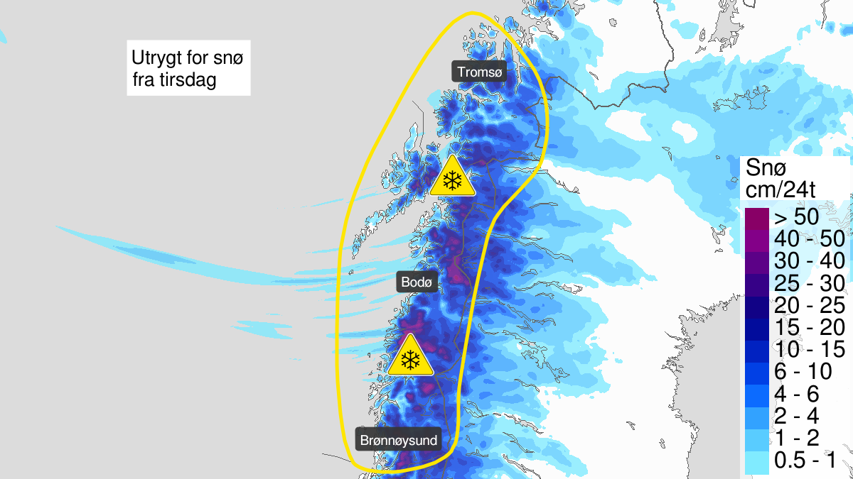
Warning from MET Norway for Nordland and Soer-Troms
2
Heavy snow, yellow level (MET)
Published:
Valid:
from 05.05.2020 20:00
to 07.05.2020 14:00
Warning
Snow
-
Sender: MET Norway
-
Danger ongoing: Tuesday, May 5, 2020, kl.8:00 PM
-
Certainty: Likely > 50%
Consequence
Travel time may increase on some journeys. Local driving conditions may become difficult. Blowing snow at higher altitudes causes reduced visibility and possibly convoys and/or closed roads.
Advice
Allow some extra time for transportation and driving. Use tires fit for winter conditions and use caution while driving. The need for emergency preparedness shall be assessed continuously by emergency response actors.
Description
Tuesday expected snow above ca 400-600 m, but early Wednesday morning expected decreasing snow line to ca 200 m. Wednesday afternoon teh snow line will rise to 400-600 m again, but early Thursday morning it becomes colder with snow above 0-200 moh.