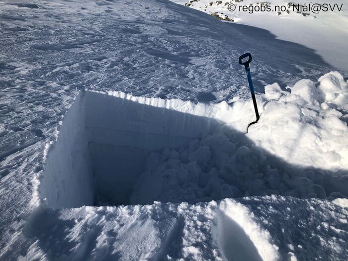
Image 1 of 10 Of: Snow Profile Copyright: Njål@SVV
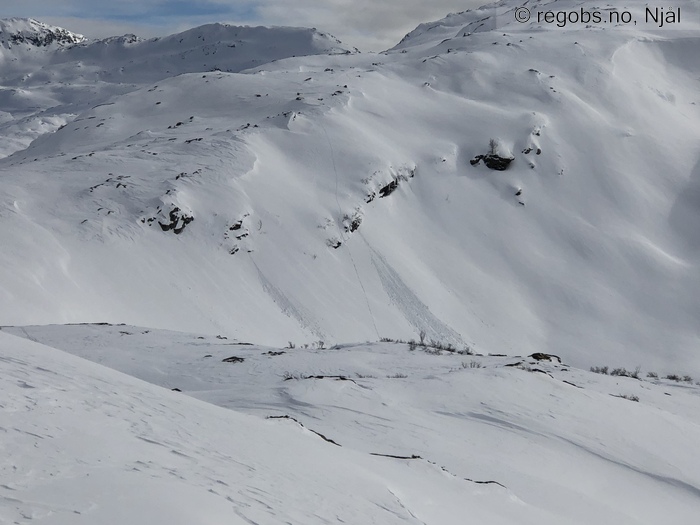
Image 2 of 10 Of: Avalanche Activity Copyright: Njål@SVV Comment: Snøballer rullet så snart solen kom skikkelig frem.
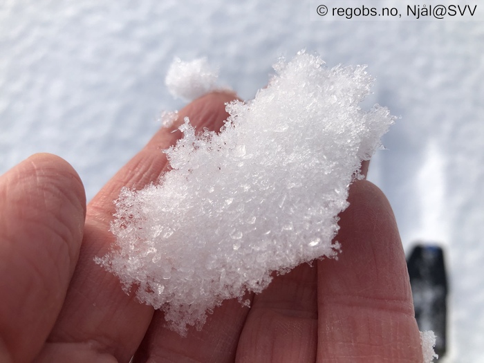
Image 3 of 10 Of: Snow Cover Copyright: Njål@SVV Comment: Rimkrystaller ca 5 mm i alle høydenivå
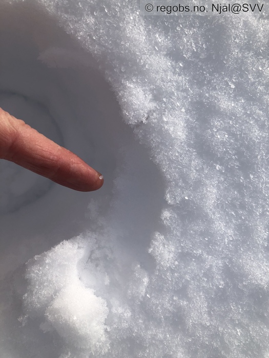
Image 4 of 10 Of: Snow Cover Copyright: Njål@SVV Comment: Tynn skare under 2 cm løssnø og rimkrystaller ca 650 m o.h.
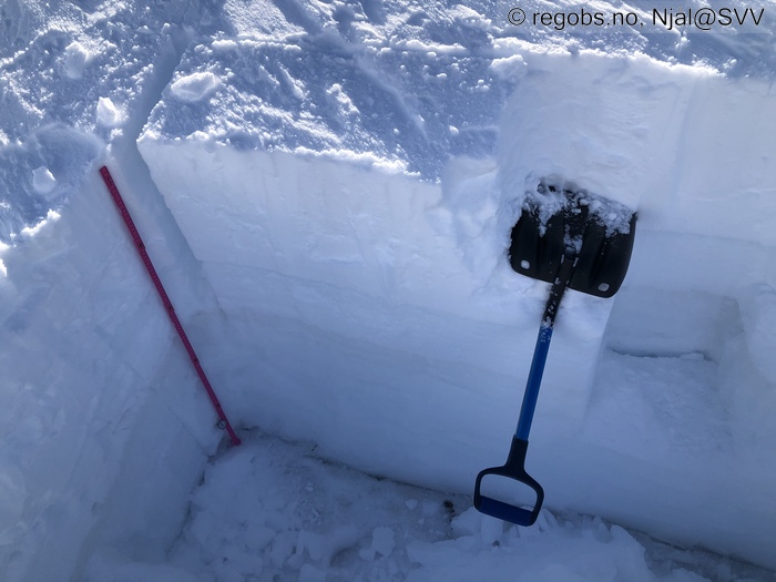
Image 5 of 10 Of: Tests Copyright: Njål@SVV Comment: Kun knusing av blokk ved ECTX
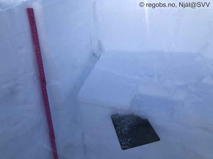
Image 6 of 10 Of: Snow Profile Copyright: Njål@SVV Comment: Kantlag under islaget
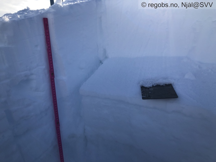
Image 7 of 10 Of: Snow Profile Copyright: Njål@SVV Comment: Lag med nysnø som gir glatt brudd, men dårlig bruddforplantning
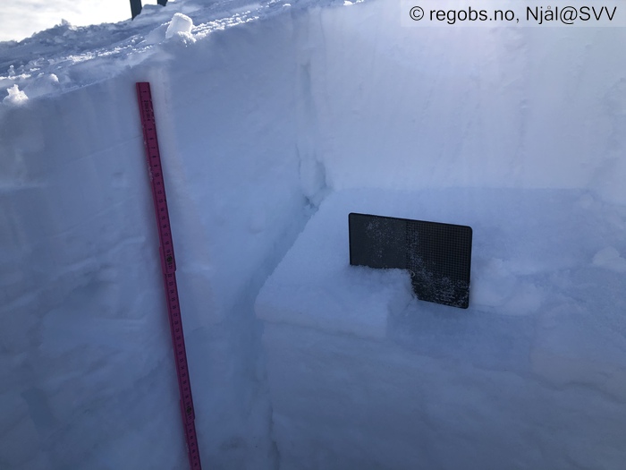
Image 8 of 10 Of: Snow Profile Copyright: Njål@SVV Comment: Fokksnøen binder godt til islaget
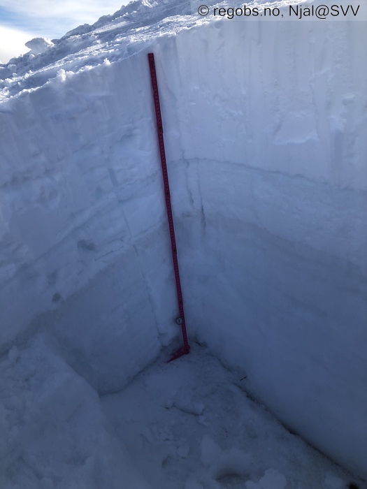
Image 9 of 10 Of: Snow Profile Copyright: Njål@SVV Comment: Tydelig islag under fokksnøen
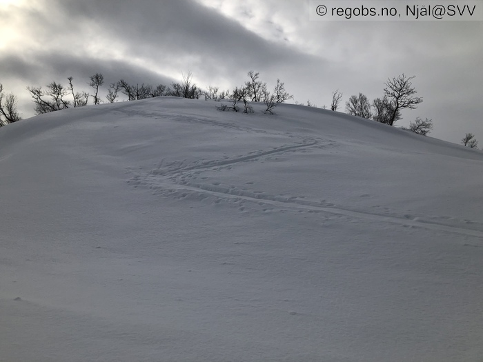
Image 10 of 10 Of: Avalanche Danger Assessment Copyright: Njål@SVV Comment: Gjenføykede eldre skispor. Dette viser at vinden har jobbet med snøen. Alikevel er det godt skiføre på grunn av oppbyggende omvandling.
Danger Sign
• Whumpf sound • Et enkelt lite drønn ca 1000 m o.h.
Avalanche Activity
• 18. Mar. 12-18 (+01:00) • Loose wet avalanche • Several (6-10). 1 - Small. Spontaneous release • Few steep slopes. SE, S, SW, W • Solen brøt gjennom litt ca klokken 14 og det begynte straks med små våte løssnøskred (rullende snøballer fra områder under fremstikkende berg).
Snow Cover
• 100 cm • No snowdrift • 0 cm • Elevation of new snow 0 masl. Snow line at 500 masl. Layered snow begins at 600 masl • Some loose snow (1-10cm) • Dry
Tests
• ECTX • Good • Finner lag med nedføyket nysnø som bryter glatt, men ikke bruddforplantning.
Snow Profile
• Persistent weak layer: thin layer, below slab, near surface • 11 temperature points observed
Avalanche Problems
• Dry slab avalanche • Buried weak layer of new snow • Within half a meter • The weak layer collapses easily and clean (easy propagation). • Difficult to trigger • 1 - Small • Some steep slopes N, NE, S, SW, W, NW above 700 masl • Nysnø innad i fokksnøen har stabilisert seg godt.
• Loose wet avalanche • Loose snow • Spontaneous release • 1 - Small • Some steep slopes SE, S, SW, W above 600 masl
• Dry slab avalanche • Buried weak layer of faceted snow beneath a crust • Within half a meter • The collapsing weak layer is thin < 3 cm. A big and identifiable crystal in the weak layer. • Very difficult to trigger • 3 - Large • Some steep slopes N, NE, E, SE, S, SW, W, NW between 1100 masl and 800 masl • Kantkorn under skare er svært godt armert av et overliggende islag opp til ca 1050 m o.h. Virker fornuftig å ha nedre grense på 1100 m o.h. for dette skredproblemet i varselet.
Avalanche Danger Assessment
• Det foregår oppbyggende omvandling av snødekket i de øverste 5 til 10 cm. Tidligere hardere fokksnøformer (sastrugi) begynner å mykne opp. Dette gir godt skiføre:) I den nye fokksnøen så er det lag av løs nysnø som bryter glatt, men viser dårlig evne til bruddforplantning. Fokksnøen har stabilisert seg godt. Opp til ca 1050 m o.h. er det et markant islag under fokksnøen. Islaget armerer godt løsere lag av kantkorn dypere i snødekket, og det virker fornuftig at det oppgis i varselet at det kan være mulig å påvirke kantkorn fra ca 1100 m o.h. Fokksnøen binder seg svært godt til islaget der jeg grov i dag, så overgangen mellom fokksnøen og islaget fremsto ikke som et skredproblem. Det går våte løssnøskred i bratt terreng når solen kikker frem. Det er funnet rimkrystaller på overflaten i alle høydenivå i dag, men disse er små, ca 5 mm. • Sol og varme vil påvirke snødekket i solvendt terreng. Fortsatt oppbyggende omvandling pga endringer i døgntemperatur. • 2 Moderate • Forecast correct

