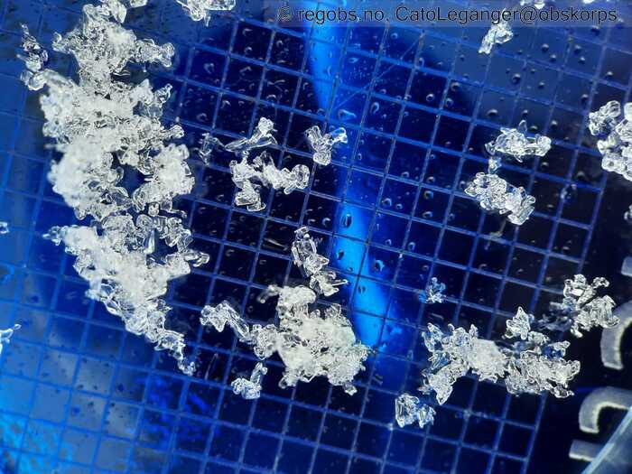
Image 1 of 6 Of: Tests Copyright: CatoLeganger@obskorps Comment: Smelter fort på plata. Kantkorn over skarelag byrjar å miste potensiale - spesielt i solvendte sider.
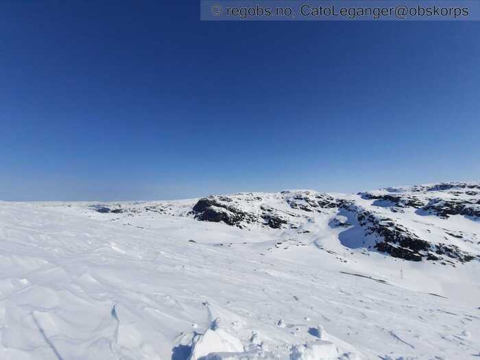
Image 2 of 6 Of: Weather Copyright: CatoLeganger@obskorps Comment: Nordaust.
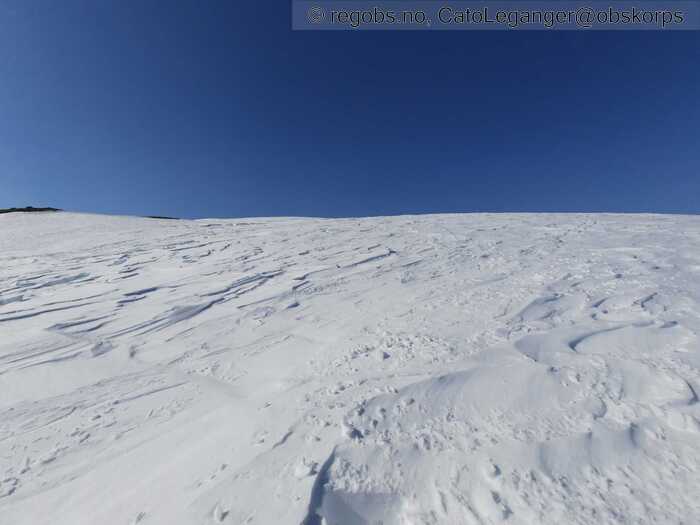
Image 3 of 6 Of: Snow Cover Copyright: CatoLeganger@obskorps
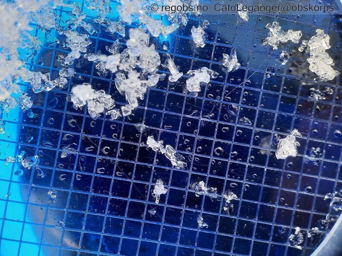
Image 4 of 6 Of: Tests Copyright: CatoLeganger@obskorps
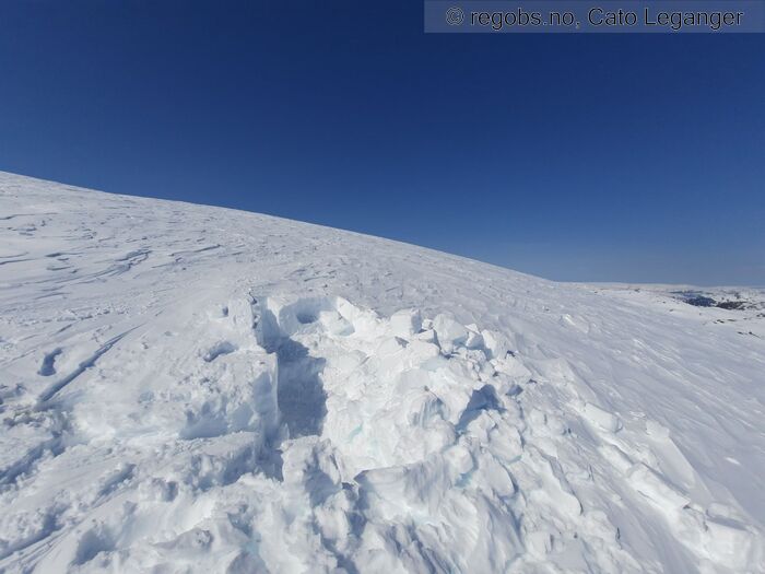
Image 5 of 6 Of: Snow Cover Copyright: CatoLeganger@obskorps Comment: Bombekrater av ei snøgrop.
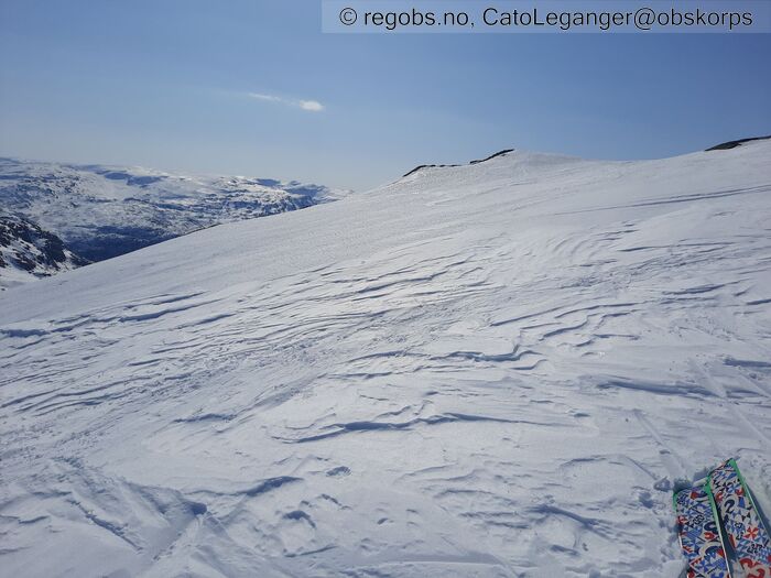
Image 6 of 6 Of: Snow Cover Copyright: CatoLeganger@obskorps Comment: Våt snøoverflate. Den gamle skaren, som enkelte plasser er framme i dagen, er gjennomfukta og fin å køyre på ski på.
Danger Sign
• No signs observed • Område: Generelt på fjellet. Skildring: Litt tidlig på dag til at skredaktiviteten har byrja. Oppdatert; Kun våte laussnøskred av str. 1 utover dagen. Hadde relativt godt utsikt til mykje terreng, men kunne ikkje sjå våte flakskred mtp skredproblem - kantkorn.
Weather
• No precipitation • 2 °C • 3 m/s from S ↑ • 5% clouds • Klart vêr i dag også. Varmt i sola. Moglegvis den varmaste dagen hittil. Sola tok godt utover dagen. Råte snødekke utover ettermiddagen.
Snow Cover
• 140 cm • No snowdrift • 0 cm • Snow line at 600 masl • Wet loose snow • Moist • Vårføre. Frys på natta og tiner om dagen. Variasjon i regionen mtp grense for samanhengande skiføre. Sjå tidl. obs for info.
Tests
• LBT@40cm(Q2) • Kantkorn.
• ECTX • Medium • Bryter greit ut med lett-middels kraft m spade bak. Får ikkje forplantning ved ect.
• CTM15@40cm(Q2) • Medium • Kantkorn.
Snow Profile
• 3 tests connected to snow profile • Persistent weak layer: thin layer, below slab, near surface • 7 temperature points observed
Avalanche Problems
• Loose wet avalanche • Loose snow • Spontaneous release • 2 - Medium • Some steep slopes NE, E, SE, S, SW, W above 700 masl
• Wet slab avalanche • Buried weak layer of faceted snow above a crust • Within half a meter • The collapsing weak layer is thin < 3 cm. A big and identifiable crystal in the weak layer. • Difficult to trigger • 3 - Large • Few steep slopes N, NE, E, SE, S, SW, W, NW above 900 masl • Laget er der, men opplever det ikkje veldig potent mtp propagering her mot aust og tilgrensande sektorar. Vil anta at det er meir potent i mindre solpåvirka sektorar/formasjonar - mot nord. Der vil det moglegvis vere lett å trigge. Godt mogleg det kan gå ut str 3 skred på dette, men i solhellingane byrjar dette laget å verte gjennomfukta til underliggande krame-fuktige smelteformer. Det vil nok fryse att om temp. synker. Kan snart isolere problemet til sektorar mot nord og dels tilgrensande sektorar.
Avalanche Danger Assessment
• Stor variasjon i regionen. Ver obs på våte laussnøskred i solvendte sider - auka fare utover dagen. Ver også obs på at det framleis er vedvarande svakt lag i snødekket. Dette er ikkje like aktuelt over alt i regionen, men går det ut skred på dette laget så kan dei verte store. Mest aktuelt mot nord-nordvest. • Kan snart isolere "Kantkorn over skarelag" som skredproblem mot nord-nordvest. Byrjar å verte gjennomfukta og meir avrunda i solvendte sider samanlikna med for nokre dagar sidan. Lar det stå gjennom morgondagen. Nedbør i form av snø og til dels i kombinasjon med vind tysdag kveld og gjennom onsdag vil kunne gi mindre fokksnøflak mot søraust, men sola tek godt, og mot slutten av veka skal det igjen vere tilnærma skyfritt. Vil anta at dette kjem til å ta knekken på evt. fokksnø relativt kjapt. FG 2 for dei neste dagane. • 2 Moderate • Litt høgt med fg 3, men skjønar grunnlaget. Landar litt mellom fg2 og fg3, avhengig av kor lett det er å løsne ut våte flak på kant. FG 2 for neste dagar.

