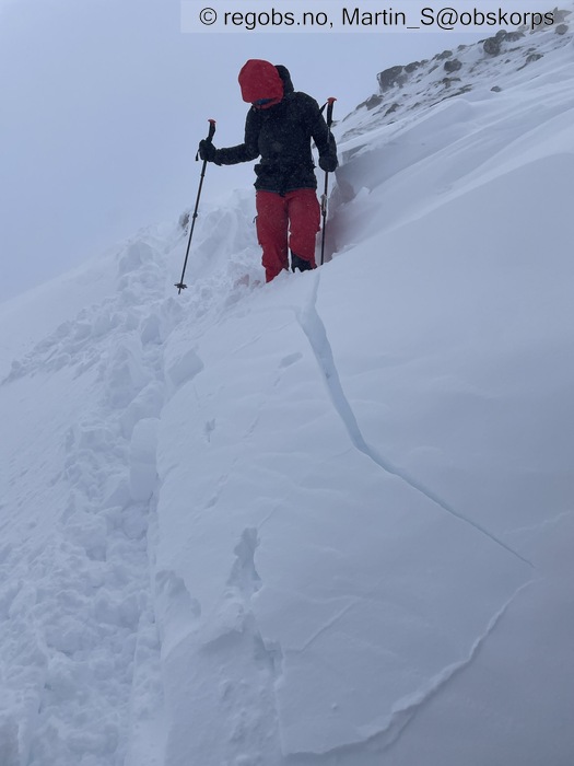
Image 1 of 11 Of: Danger Sign Copyright: Martin_S@obskorps
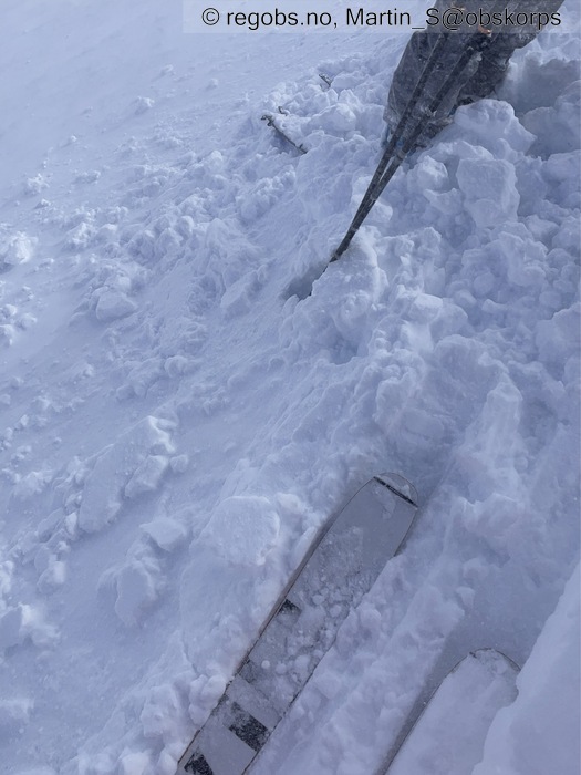
Image 2 of 11 Of: Danger Sign Copyright: Martin_S@obskorps
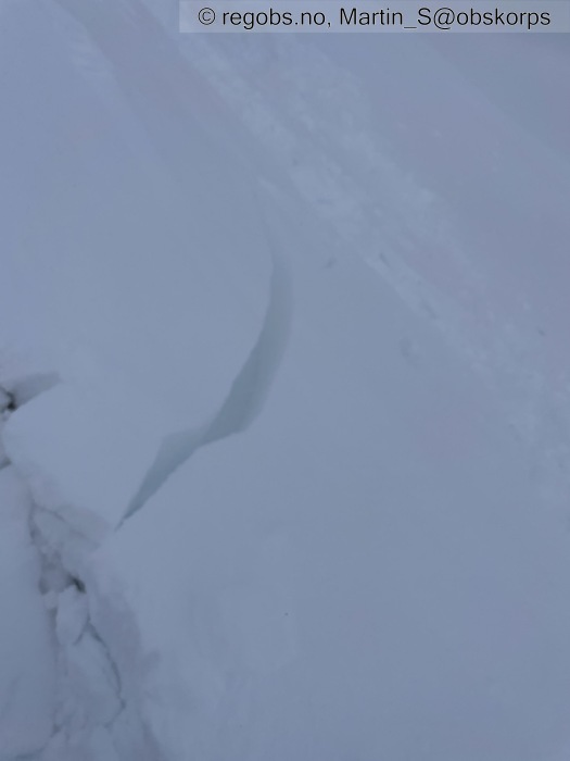
Image 3 of 11 Of: Danger Sign Copyright: Martin_S@obskorps
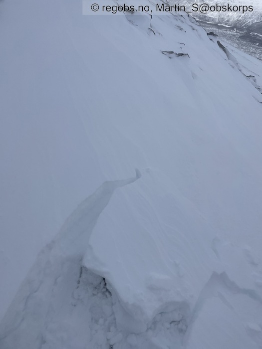
Image 4 of 11 Of: Danger Sign Copyright: Martin_S@obskorps
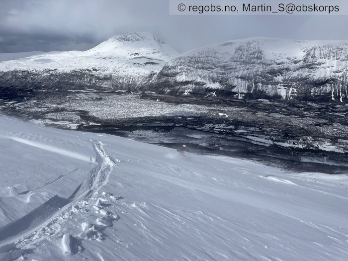
Image 5 of 11 Of: Weather Copyright: Martin_S@obskorps
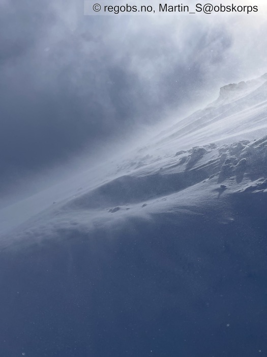
Image 6 of 11 Of: Weather Copyright: Martin_S@obskorps
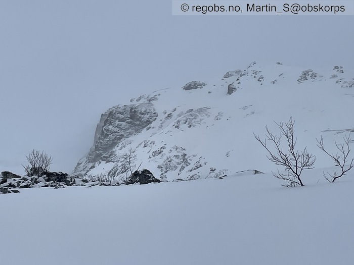
Image 7 of 11 Of: Weather Copyright: Martin_S@obskorps
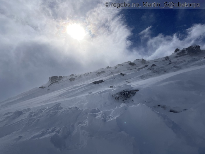
Image 8 of 11 Of: Snow Cover Copyright: Martin_S@obskorps
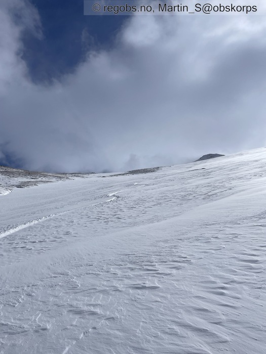
Image 9 of 11 Of: Snow Cover Copyright: Martin_S@obskorps
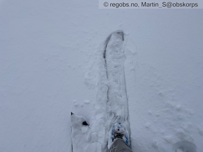
Image 10 of 11 Of: Snow Cover Copyright: Martin_S@obskorps
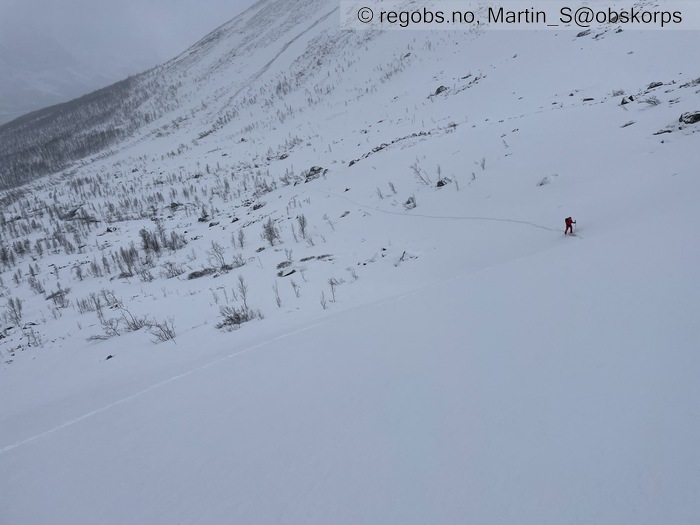
Image 11 of 11 Of: Snow Cover Copyright: Martin_S@obskorps
Danger Sign
• Shooting cracks • Sprekker 2-5m lange der det føyker inn. Typisk 20 cm dyp, men der det laster inn som mest opp mot 60cm og mer.
Avalanche Activity
• 20. May. During the day (+02:00) • No avalanche activity • Løste ut noen veldig små flak i testheng, ellers kunne jeg ikke se noe
Snow Cover
• Moderate snow drift • 10 cm • Elevation of new snow 0 masl. Snow line at 0 masl. Layered snow begins at 0 masl • Much loose snow (10-30cm) • Dry • Har kommet ca 5 cm snø i skogen, og trolig opp mot 10cm eller mer i høyden, men vinden har tatt så ikke helt godt å si. Generelt sett i dette terrenget som er i lo har vinden laget F-4F flak typisk 10-20 cm tykke over 500 moh, eller så er det avblåst. Enkelte steder er flakene opp mot en halvmeter eller tykkere, men det er veldig lokalt bak steiner og lignende. Genrelt ligger flaken på nedføyket tørr DF enten rett på eller noen cm over gamle snødekket. Det er tendenser til dårlig binding men ikke eksplosivt. Det gamle snødekket består av bærende, men fuktig, skare over skoggrensa, med våt snø under, se obs fra i går på Andersdalstinden. Enkelte steder mellom steiner og slikt er det råttent.
Weather
• Snow • 0 °C • 13 m/s from NW ↘ • 100% clouds • Bygevær, alt fra sol og laber bris til liten kuling og snøfall. Tipper det var rett rundt null nede ved veien, og kaldere i høyden.
Snow Profile
• Eksempel på typisk flakdannelse i pålagret terreng • 4 Stratigraphy layers
Avalanche Problems
• Dry slab avalanche • Buried weak layer of new snow • Within half a meter • Easy to trigger • 2 - Medium • Some steep slopes N, NE, E, SE, S above 500 masl • Var ikke voldsomt potent der vi var, men tipper det er lettere å løse ut jo høyere man kommer seg. Var egentlig ikke i optimal terreng for dette problemet siden det blåser vest-nordvest, men likevel lastet det inn bra i nordøstvendt terreng. Vil tro at rett øst til sør med store henteområder er verst.
• Loose wet avalanche • Loose snow • Spontaneous release • 1 - Small • Many steep slopes SE, S, SW, W below 1000 masl • Jeg klarte ikke å se noen aktivitet, men dersom solbygene blir intense ser jeg for meg at den ferske snøen vil løsne lett.
Avalanche Danger Assessment
• Snøfokk og ferske flak var åpenbare, men var ikke veldig potente i dette terrenget. Det er stor potensiale med så mye fukt i snødekket, mtp varmen som var 17. mai. Jeg så ikke noe tegn til kantkorn under de ferske flakene der jeg var, men det er vanskelig å utelukke særlig i høyden der det kanskje er kaldere. • Solbygene er litt uforutsigbare. Dersom det er mest overskyet tenker jeg at de ferske flakene stabiliserer seg raskt. Dersom det blir mer klarvær i natt er potensialen for å få kantkorn til stede med tanke på fuktig gammel snø og ugunstig lagdelning. Dette vil i så fall holde flakene ustabile i morgen også, og kanskje til og med at varmen som kommer kan løse ut enkelte skred. Etter hvert vil varmen gjøre at det stabiliserer seg, og vi går tilbake til vårsnø. • 2 Moderate • Forecast correct • Fra hva jeg kan se treffer det godt

