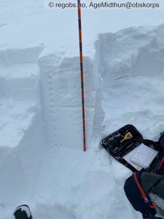
Image 1 of 7 Of: Snow Profile Copyright: ÅgeMidthun@obskorps Comment: Profil ned til gammelskaren som i denne høyden anses som en solid og stabil bunnpakke.
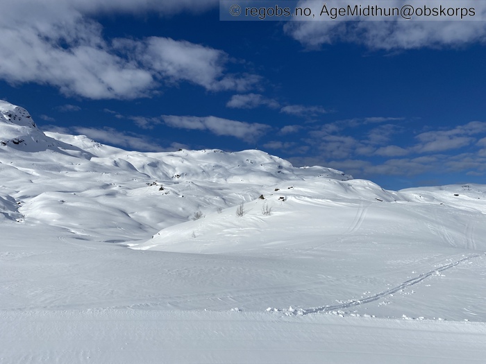
Image 2 of 7 Of: Weather Copyright: ÅgeMidthun@obskorps Comment: Fra Djuvsbotn (Sauda skisenter) mot nordsida av Vardanuten 1111 moh. Startet ut i strålende vær, men vinden tiltok med høyden og etterhvert la skydekket seg ned over fjella.
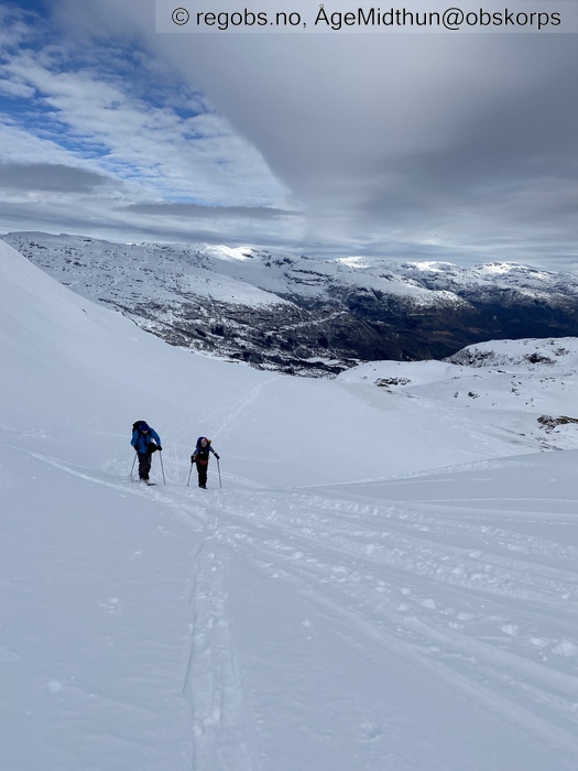
Image 3 of 7 Of: Weather Copyright: ÅgeMidthun@obskorps Comment: Tilskyende utover dagen.
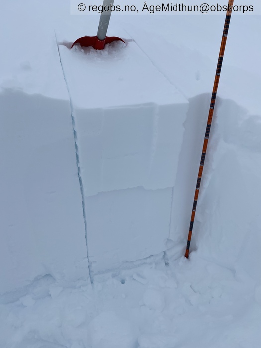
Image 4 of 7 Of: Tests Copyright: ÅgeMidthun@obskorps Comment: I tillegg til CT-resultatet fikk jeg utslag på shovelshear anslagsvis STM@30 cm i kantkornlaget der, Q2. Kantkorna er tydelige med ikke store nok til at de ga utslag. Forsøkte også å få respons med LBT, uten noen respons i den isolerte blokka.
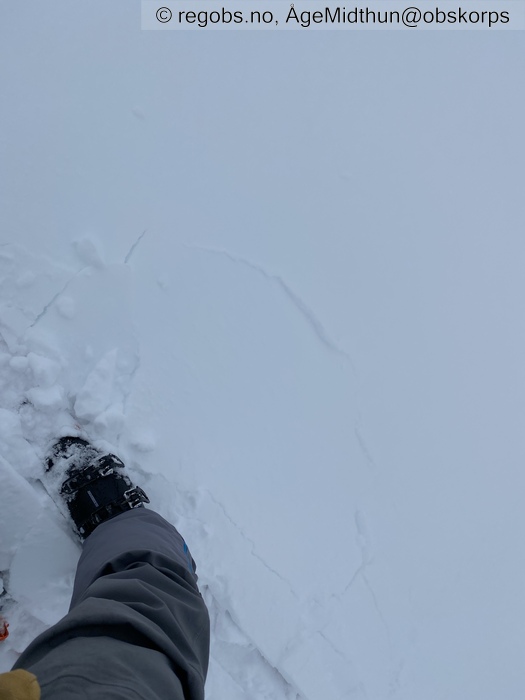
Image 5 of 7 Of: Avalanche Problems Copyright: ÅgeMidthun@obskorps Comment: Fersk fokksnø som bryter lokalt rundt skia.
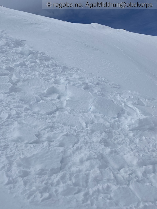
Image 6 of 7 Of: Avalanche Problems Copyright: ÅgeMidthun@obskorps Comment: Lite flakskred fra søndag/mandag. Bruddkanten er føyka igjen, altså har det vært noe ny pålagring i senere tid.
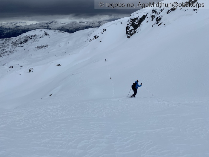
Image 7 of 7 Of: Avalanche Danger Assessment Copyright: ÅgeMidthun@obskorps Comment: Brukbart skiføre rundt 800moh. Litt ulik bæreevne i fokksnøen krever at man står litt «på» og kjører aktivt for ikke å bli vippa av pinnen:)
Danger Sign
• Recent snowdrift • Tynne, myke småflak som følge av pågående pålagring. Må mer vind til for å flytte på større mengder snø. Foreløpig begrenset utbredelse av problemet.
Weather
• No precipitation • -1.5 °C • 8 m/s from SW ↗ • 100% clouds • Skredproblem fokksnø bør korrigeres på vindretning ift dagens varsel. Det er i hovedsak nord og nordøst sektor som har fått pålagring siste tid i denne del av regionen.
Snow Profile
• Skarpt skille mellom gammelt og «nytt» i snødekket. • Persistent weak layer: thin layer, below slab, near surface • 6 temperature points observed
Avalanche Problems
• Dry slab avalanche • Buried weak layer of faceted snow near surface • Within half a meter • The overlying slab is soft. • Difficult to trigger • 2 - Medium • Some steep slopes N, NE, E, SE above 800 masl
Avalanche Danger Assessment
• Inntil videre en jevn faresituasjon, og farevurderingen som er varslet siste uke har virket presis. Kalde netter har omdannet øvre del av snøen til overflatenære kantkorn, slik at den litt vanskelige fokksnøen har blitt løsere og lettere. Dette oppleves også som skikjører. Likevel er det under 1000 moh stor variasjon i snødekket. Fremdeles bærende fokksnø, andre steder er den nesten helt «spist opp» av kulda. Over 900 moh har vinden erodert bort snøen helt nedpå gammelskaren som vises som brunaktig snøoverflate pga saharasanden.
I solvendte heng varmer det godt høyt opp på fjellet nå, så det løsner mange våte løssnøskred (relativt små og harmløse foreløpig). • Forventer ingen store endringer i situasjonen på kort sikt. Det er lite snø tilgjengelig for transport så lenge vindstyrken er moderat. Det må litt mer kraft i vinden for å grave og flytte på snø. Temperaturen er på vei opp lørdag, noe som vil bidra til stabilisering. Regn lørdag ettermiddag kan fukte snødekket i høyden og eventuelt bidra til våt snø i sørlig sektor når/hvis søndagens sol får ta tak. Kanskje ikke et skredproblem enda, men verdt en note i varselet at man skal være litt oppmerksom på mindre, våte løssnøskred søndag dersom sola får jobbe litt.
Største endringen værmessig ligger litt utover i uka. Da tenker jeg at vi kan få en del regn på snødekket fremover mot palmehelga, og vil ikke bli overrasket hvis vi får omslag til våte skredproblem generelt. • 2 Moderate • Forecast correct • Faregraden beskriver situasjonen godt. Jevnt over stabilt, men likevel noen bratte leheng man skal være litt oppmerksom på når man ferdes i fjellet.

