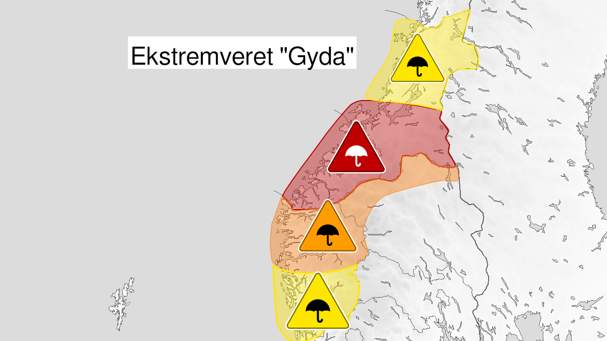
Warning from MET Norway for Sør-Trøndelag
4
Extremely heavy rain, red level (MET)
Published:
Valid:
from 12.01.2022 14:00
to 13.01.2022 20:00
Warning
Rain
-
Sender: MET Norway
-
Danger ongoing: Wednesday, January 12, 2022, kl.2:00 PM
-
Danger decrease: Thursday, January 13, 2022, kl. 8:00 PM
-
Certainty: Likely > 50%
Name
Gyda
Consequence
Risk of flooding of low-lying densely populated areas. Check varsom.no for more information. Locally difficult driving conditions, especially at waterways. Roads can be closed. Many journeys will have longer travel time. Road conditions affected with road spray and hydroplaning in a few places. Some places may temporarily lose the road connection, often several days. Buildings and structures can collapse as a result of the rainfall. Danger to life in fast flowing/deep water. Danger of long power outages.
Advice
Consider the need for preventive measures. Follow the advice of emergency authorities, both local and governmental. The need for emergency preparedness shall be assessed continuously by emergency response actors. Avoid driving in flood water without knowing how deep it is. Carefully consider whether the journey is necessary. Prepare your home for a potentially long power outage.
Description
From Wednesday afternoon until early Thursday evening it is expected 80-120 mm/24h, locally perhaps even more. Most precipitation is expected south of Trondheim.