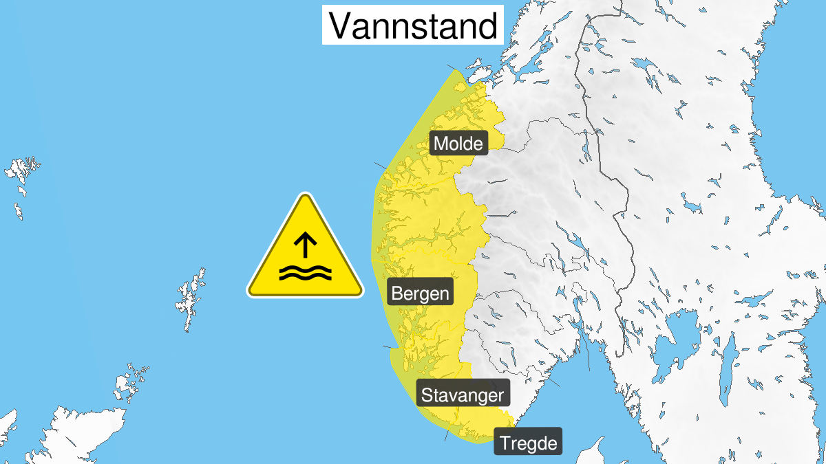
Warning from MET Norway for Vestlandet
2
High water level, yellow level (MET)
Published:
Valid:
from 01.11.2020 22:00
to 02.11.2020 13:00
Warning
Water level at the coast and in the fjords
-
Sender: MET Norway
-
Danger ongoing: Sunday, November 1, 2020, kl.10:00 PM
-
Danger decrease: Monday, November 2, 2020, kl. 1:00 PM
-
Certainty: Likely > 50%
Consequence
Local flooding and risk of minor damage to infrastructure and buildings in the beach zone.
Advice
Be careful in coastal areas. Check the mooring of the boat and secure objects near the water in the coastal zone.
Description
Forecast for the area Tregde to Ålesund: Late Sunday evening until Monday afternoon high water level is expected, estimated to 40-60 cm above the height given in the tide tables, in combination with high waves. The water level is is expected to be at its highest Sunday 2300 to 0100 Monday morning and then again Monday 1100-1300. For the coastal stretch Tregde to Stavanger this forecast is most relevant for the high tides Monday morning 0400-0600.