Warning from MET Norway for Kyst- and fjordstroekene i Finnmark
2
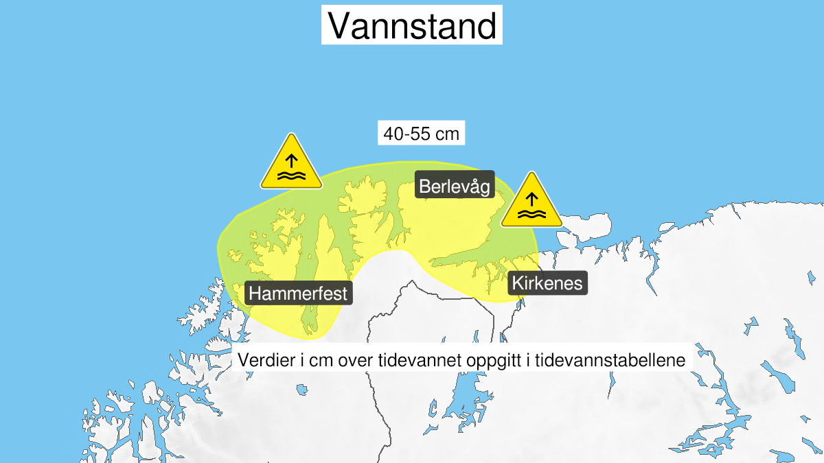
High water level, yellow level (MET)
Published:
Valid:
from 21.09.2020 17:00
to 22.09.2020 10:00
Warning
Water level at the coast and in the fjords
-
Sender: MET Norway
-
Danger ongoing: Monday, September 21, 2020, kl.5:00 PM
-
Danger decrease: Tuesday, September 22, 2020, kl. 10:00 AM
-
Certainty: Likely > 50%
Consequence
Local flooding and risk of minor damage to infrastructure and buildings in the beach zone.
Advice
Be careful in coastal areas. Check the mooring of the boat and secure objects near the water in the coastal zone.
Description
Forecast for the area Hammerfest to Grense Jakobselv: Monday evening and Tuesday morning high water level is expected, estimated to 40-55 cm above the heights given in the tide tables. The water level is expected to be at its highest Monday 18-21 and Tuesday 06-09. More information on tides and waterlevel at sehavniva.no