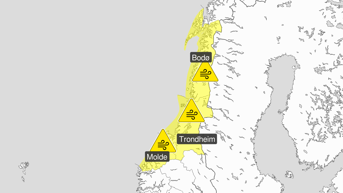
Warning from MET Norway for Troendelag and Helgeland
2
Strong wind gusts, yellow level (MET)
Published:
Valid:
from 03.01.2020 16:00
to 04.01.2020 07:00
Warning
Wind gusts
-
Sender: MET Norway
-
Danger ongoing: Friday, January 3, 2020, kl.4:00 PM
-
Danger decrease: Saturday, January 4, 2020, kl. 7:00 AM
-
Certainty: Likely > 50%
Consequence
Loose items may be taken by the wind. Possibly cancelled departures for ferry, plane, or other transport. Bridges may be closed. Some journeys may have longer travel times. The power supply may be impacted, due to tree(s) falling over. Some roads may be closed due to trees or other objects in the road. Blowing snow at higher altitudes causes reduced visibility and possibly convoys and/or closed roads.
Advice
Secure loose objects. Avoid unnecessary journeys to exposed places. Follow advice and check status from transport operators. Check road reports (175.no).
Description
Late Friday a storm center is expected at the coast between Trondheim and Lofoten. Expect southwest storm force 10 at the coast, and early Saturday morning veering northwest. Expect wind gusts around 35 m/s inland.