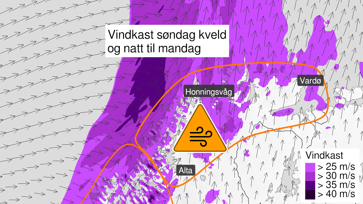
Warning from MET Norway for Kyst- and fjordstroekene i Finnmark
3
Very strong wind gusts, orange level (MET)
Published:
Valid:
from 23.01.2022 18:00
to 24.01.2022 07:00
Warning
Wind gusts
-
Sender: MET Norway
-
Danger ongoing: Sunday, January 23, 2022, kl.6:00 PM
-
Danger decrease: Monday, January 24, 2022, kl. 7:00 AM
-
Certainty: Likely > 50%
Consequence
Larger loose items may be taken by the wind. Risk of damage to buildings and infrastructure. Bridges may be closed. Many journeys may have longer travel times. Blowing snow at higher altitudes causes reduced visibility and possibly convoys and/or closed roads. Blowing snow causes reduced visibility and possibly convoys and/or closed roads. High waves may cause damage to infrastructure and buildings in the coastal zone. The strong wind may cause locally high waves in fjords and lakes.
Advice
Secure all loose objects. Avoid exposed places. Allow a lot of extra time for transportation and driving. Follow advice and check status from transport operators. Check road reports (175.no). The need for emergency preparedness shall be assessed continuously by emergency response actors. Be careful in coastal areas.
Description
From Sunday evening southwest severe gale force 9 or occasionally storm force 10 in exposed places, with local very strong gust 30-37 m/s. Monday morning decreasing.