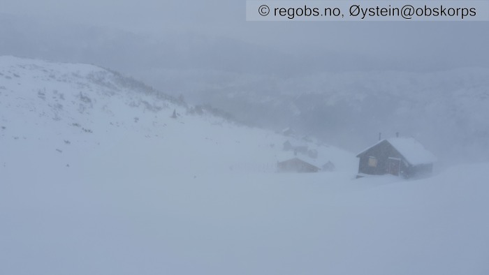
Image 1 of 8 Of: Danger Sign Copyright: Øystein@obskorps Comment: Østover fra stølene ved Steinset, ca 800 moh. Periodevis kraftig snøfokk.
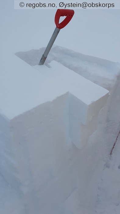
Image 2 of 8 Of: Tests Copyright: Øystein@obskorps Comment: De to øverste bruddene i LBT kom i de samme lagene som vises på bildet.
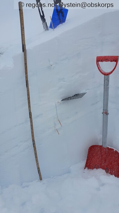
Image 3 of 8 Of: Snow Profile Copyright: Øystein@obskorps Comment: Rasterplata står ved skarelaget under nysnøen som har kommet de siste 48 timene.
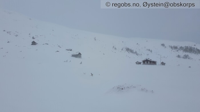
Image 4 of 8 Of: Snow Cover Copyright: Øystein@obskorps Comment: Hytter ved Steinset. Bildet er tatt nordover på ca 800 moh.
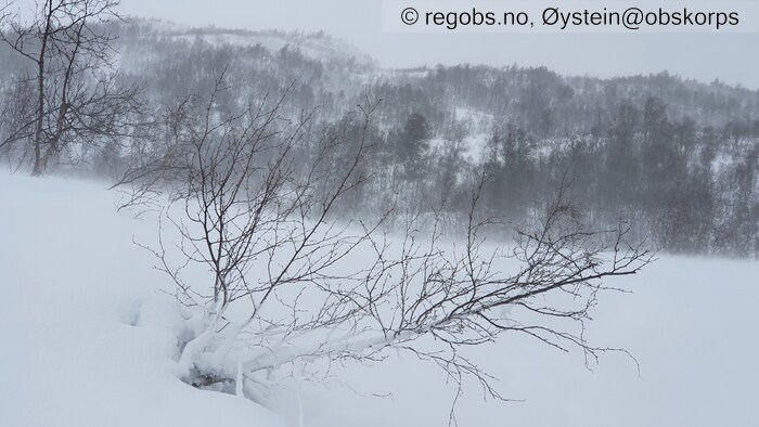
Image 5 of 8 Of: Snow Cover Copyright: Øystein@obskorps Comment: Pågående vindtransport på vind fra NV, også under tregrensa. Her fra ca 640 moh.
Image 6 of 8 Of: Snow Cover Copyright: Øystein@obskorps Comment: Ca 500 moh. Ca 10 cm fuktig til våt nysnø fra siste døgn. Tydelige smelteriller etter regnvær i natt.
Image 7 of 8 Of: Snow Cover Copyright: Øystein@obskorps Comment: Fra P-plass ved Lund, ca 440 moh.
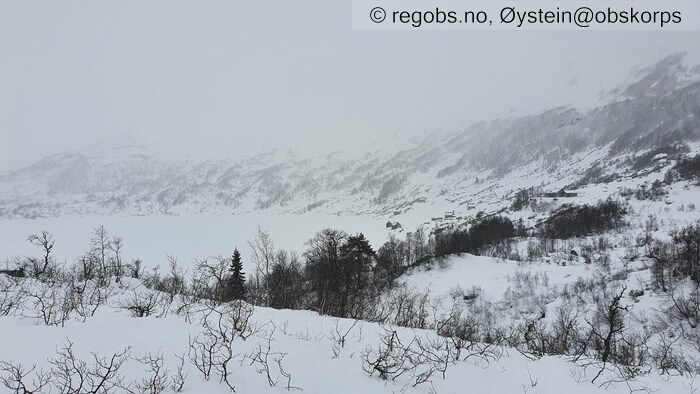
Image 8 of 8 Of: Snow Cover Copyright: Øystein@obskorps Comment: Skreiavatnet (630 moh) og stølene under Skreieggi. Bildet er tatt fra Ø.
Danger Sign
• Recent snowdrift • Pågående vindtransport på vind fra NV. Moderat til kraftig snøfokk.
Avalanche Activity
• 27. Jan. During the day (+01:00) • No avalanche activity • Hadde svært begrensa sikt i dag.
Weather
• Snow • 0 °C • 8 m/s from NW ↘ • 100% clouds • Et kraftig nedbørssystem har passert regionen det siste døgnet. Det har gitt 20-40 cm nysnø over 700m. Temperaturen har variert litt, med regn opp til ca 1000m i natt. Periodevis nedbør som snø ned til ca 400 moh i går formiddag og i går kveld. Nå har vinden dreiet på NV med snøbyger ned til om lag 600m. Ser ut til at nedbøren er avtagende.
Snow Cover
• 140 cm • Moderate snow drift • 25 cm • Elevation of new snow 400 masl. Snow line at 300 masl. Layered snow begins at 700 masl • Some loose snow (1-10cm) • Dry • Snødekket er preget av mye nedbør og jevnt over høye temperaturer den siste tida. De siste 48 timene har snøgrensa periodevis krøpet nedover mot 4-500 meter i indre strøk. Over 700 meter er netto nysnømengde siste 48 timer minst 20 cm. Natt til i dag passerte en varmfront med kraftig nedbør og regn opp til ca 1000m. Nysnøen fra i går er derfor fuktig opp til denne høyden, og ligger under et tynt skarelag. De siste 6-8 timene har det kommet kaldere fokksnø på sterk vind fra NV. Over ca 700m er derfor snøoverflaten noenlunde tørr. Skiføret er i bedring, men det er fortsatt lite snø for årstida under 900 meter.
Tests
• LBT@8cm(Q2) • Gikk lett til brudd i lag av nedføyket, delvis nedbrutt nysnø (DF).
• LBT@30cm(Q2) • Krevde hard klapping å få til brudd.
• LBT@45cm(Q3) • Krevde hard klapping å få til brudd.
Snow Profile
• Grov profilen på et sted som gir representativ snømengde for østvendte leheng på denne høyden over havet, selv om det generelt er mindre snø i terrenget. De nederste 70-80 cm til bakken består av grovkornede, fuktige og relative løse (1F) smelteformer. • 9 Stratigraphy layers • 8 temperature points observed
Avalanche Problems
• Dry slab avalanche • Buried weak layer of new snow • Within half a meter • The collapsing weak layer is thin < 3 cm. The overlying slab is soft. • Easy to trigger • 3 - Large • Some steep slopes NE, E, SE, S above 800 masl • Skredproblemet er den ferske fokksnøen. Overgangen til vind fra NV og etterhvert lavere temperatur fører til fortsatt pålagring av fersk fokksnø i leheng som vender mot øst og sørøst. Der vinden får hente snø fra store områder over 1000m kan det dannes store fokksnøflak i noen heng. Under 1000m vil de fleste fokksnøflakene være mindre, men fortsatt lett kunne løses ut av en skiløper. Skredproblemet er størst i høyfjellet over mildværsgrensa fra siste natt. Fokksnøflakene fra gårsdagens nysnø ser ut til å stabilisere seg raskt.
Avalanche Danger Assessment
• Pågående snøfokk på sterk vind fra nordvest danner nye fokksnøflak i heng som vender mot øst, sørøst og sør. Fokksnøflakene går lett til brudd. Skredproblemet er størst over mildværsgrensa siste døgn, og i vestlige områder av regionen der nedbørsmengdene har vært størst. • Vi får nå et kortvarig værvindu med roligere vind og lavere temperatur. Fokksnøen vil trolig stabilisere seg raskt. Ny nedbør og vindøkning fra sør i morgen ettermiddag gir nye fokksnøproblemer i heng som vender mot nord. • 3 Considerable • Forecast correct

