Hardanger / Ullensvang
CatoLeganger@obskorps (***)
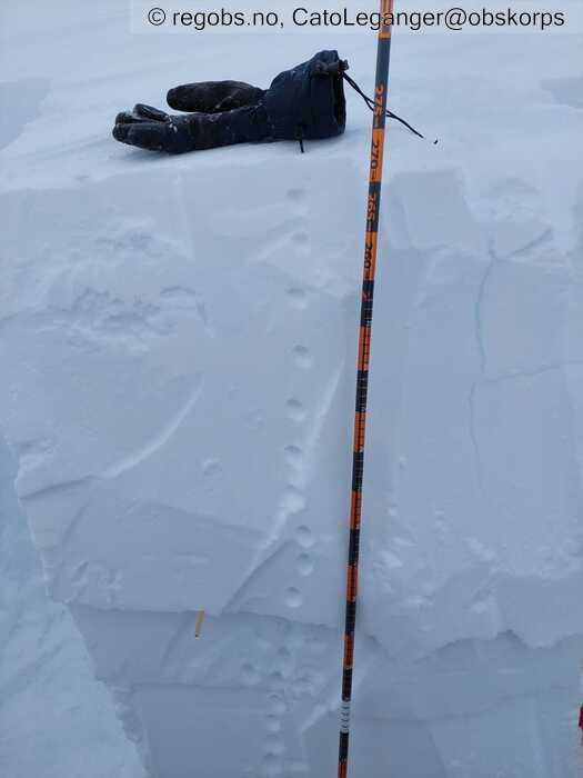
Image 1 of 6 Of: Tests Copyright: CatoLeganger@obskorps Comment: Nedføyka nysnø, leformasjon mot aust-søraust
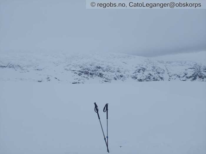
Image 2 of 6 Of: Weather Copyright: CatoLeganger@obskorps Comment: Glytt av sol på morgonen, tilskyande frå kl. 12.
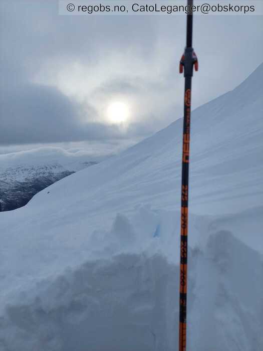
Image 3 of 6 Of: Snow Cover Copyright: CatoLeganger@obskorps Comment: Vindpåvirka.
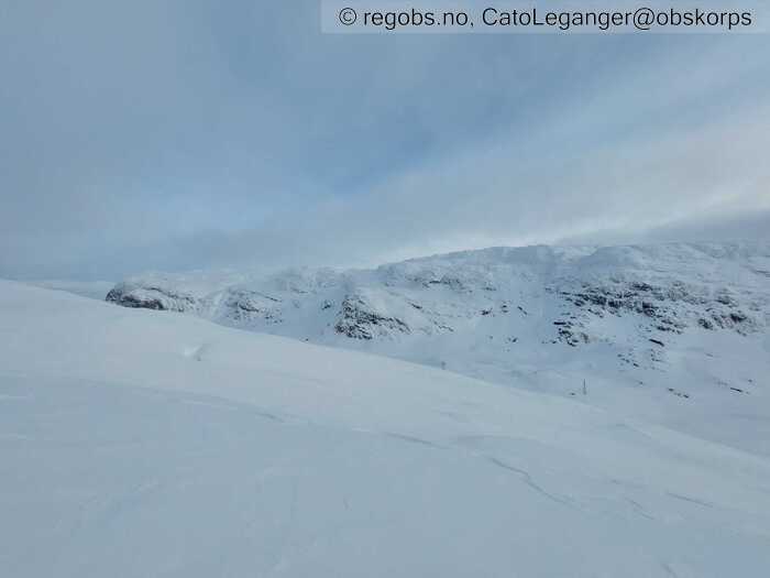
Image 4 of 6 Of: Snow Cover Copyright: CatoLeganger@obskorps
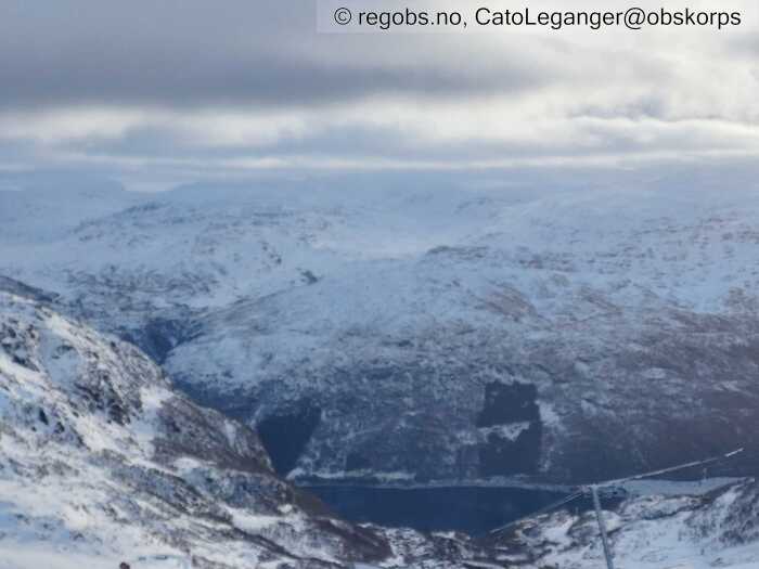
Image 5 of 6 Of: Snow Cover Copyright: CatoLeganger@obskorps
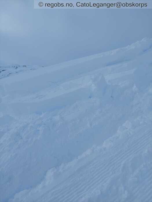
Image 6 of 6 Of: Avalanche Problems Copyright: CatoLeganger@obskorps Comment: Bilete frå trekket. Løyst ut av tråkkemaskin. Fint biletr på lagdelinga mot sør.
Avalanche Activity
• 28. Jan. 18-24 (+01:00) • Wet slab avalanche • Few (2-5). 2 - Medium. Spontaneous release • E, SE. Between 1000 masl and 800 masl • Observerte konturene av våte flakskred. Truleg eldre. Delvis nedføyka.
• 28. Jan. During the day (+01:00) • Dry slab avalanche • One (1). 2 - Medium. Spontaneous release • Few steep slopes. SE • Observerte eit relativt ferskt flakskred på sirka 1200 moh. Str 1+
Weather
• No precipitation • -5 °C • 2 m/s from W → • 100% clouds • Stille før stormen... har så smått byrja å falle litt snø, klo. 12.00. Det har vore mykje vêr siste 24+ timar. Tydeleg at vinden har herja godt - frå vest/nordvest.
Snow Cover
• 150 cm • No snowdrift • Layered snow begins at 700 masl • Wind slab (hard slab) • Dry • Varierende. Avblåst til nedpå skaren på konvekser og generelt i høgda. Bærende fokksnø med innslag av lausare snø i enkelte lommer.
Det er stor variasjon i mengde snø i regionenen. Mykje vêr frå vest og tilgrensande sektorar har ført til at det har lagt seg opp ein del snø i leformasjonar i motsette sektorar. Snømengde varierer difor frå 10-20 cm til 3 meter, avhengig av kvar du befinner deg i regionen: høgde og himmelretning og indre/vs ytre del.
Grense for samanhengande skiføre varierer stort i regionen med alt frå 600-700 moh til at det er avsmelta til 1000+ moh i andre deler av regionen. Faregraden varierer difor også STORT!
Tests
• ECTP12@58cm(Q2) • Medium • Det er potensielt eit tjukt flak som kan gå ut. Det er også lagdeling vidare ned i snødekket, så eit skred på dette kan fort trekke med seg meir masse i dei mest potente henga. Det skal i utg.pkt ein del til for å trigge dette, men om det går til brot så kan konsekvensane verte store.
Snow Profile
• 1 test connected to snow profile
Avalanche Problems
• Dry slab avalanche • Buried weak layer of new snow • Within a meter • The weak layer collapses easily and clean (easy propagation). A big and identifiable crystal in the weak layer. • Difficult to trigger • 3 - Large • Few steep slopes N, NE, E, SE, S above 900 masl • Få heng i regionen, men lokalt "noen" - der det gir meining å ferdes på ski. Kan argumentere for både fg2 og fg3 mtp på utløydbarhet og skredstr.
• Wet slab avalanche • Water pooling in/above snow layers • Within a meter • Spontaneous release • 3 - Large • Few steep slopes NE, E, SE, S between 1200 masl and 800 masl • Eigentleg er alle heng aktuelle mtp været som er meldt, men mest aktuelt mot sør-søraust-aust der det har lagt seg opp flak i seinare tid. Det er særs få heng som er aktuelt pga veldig varierande mengde snø i regionen, men dei mest utsatte områda så kan det gå skred mellom 1200-800 moh på dette. Skredproblemet er mest aktuelt frå i natt og utover morgondagen - og er veldig avhengig av nedbør som regn høgt til fjells. I høgda er snødekket relativt kompakt, så det vil ta tid og det trengs relativt stor nedbørsmengde til for at det skal drenere ned til overganger i dekket der skredproblemet kan gjere seg gjeldande. Lågare i terrenget vil nok snødekket reagere kjappere på mengden nedbør pga mindre kompakt dekke.
• Loose wet avalanche • Loose snow • Spontaneous release • 1 - Small • Some steep slopes N, NE, E, SE, S, SW, W, NW below 1200 masl • Truleg str 1 og str 2 skred kan løsne om mildværet slår til. Det er forbigåande, mest aktuelt frå natt til laurdag og utover dagen. Kunne sett "mange heng" og str 1 skred, "få heng" og str. 2. Lander difor på "noen heng" og str. 1, men at det fint kan gå str. 2 også... Snødekket er relativt kompakt der vinden har bygd opp til dels tjukke flak (varierande tjukkelse). Snødekket treng lengre tid til å reagere på mengde nedbør her vs lågare i terrenget der overflata er mindre påvirka og nedbøren lettare dreneres ned.
Avalanche Danger Assessment
• Ver obs der det har samla seg fokksnø. Faregraden stiger utover dagen i kombinasjon med auke av vind/nedbør. • Skredsituasjonen dei neste 24-36 timane er sterk avhengig av kva vær som kjem inn. Det er meldt 100-160 mm nedbør i dei mest utsatte delane av regionen og i kombinasjon med vindprognosar som tilseier storm, så seier det seg sjølv at det vert hårete i fjellet.
I dei mest utsatte områda rundt austsida av Folgefonna og i utsatte deler på Røldalsfjellet, og elles i høgareliggande deler av regionen så kan ein potensielt få ein faregrad 4. Folgefonna har fått mykje snø, der vinden har jobba frå vest og ført snø inn i leformasjonar mot aust/tilgrens.sektorar - om det kjem nedbør ifm av den mengde som er meldt, så kan ein få større skredaktivitet i skredløpa som går frå fonna og like til fjorden. For traktene rundt Røldal så kan ein også få ein utfordrande skredsituasjon, spesielt i høgda - rundt 800-1000 moh og opp. Det er meldt mildvær opptil ca 1200 moh og store nedbørsmengder ifm regn neste 16 t. Slår dette til så kan ein få ein del større våte flakskred.
Variasjon i regionen. Enkelte deler vil ha FG1.
• 3 Considerable • Som tidligere nemt er det litt utfordrende å sette faregrad for tida. Store deler av regionen har FG1 og 2, men der det gir mest meining å ferdes på ski, i alle fall alpine turski, så er det nok sterk FG2 eller svak FG3 i skrivande stund. Det har stabilisert seg ganske raskt så FG2 og FG3 og str 2 og 3 skred kan gi meining, men magefølelsen seier FG2 tidleg på dag, fredag, med tekst der ein understreker at det kan finnes ustabile flak som kan gi store skred. Aukande faregrad utover dagen, så totalt gir FG3 meining i dag.
Notes
• Redigere obs seinare. Legg inn meir info då. Køyre bil halvanna time no. Berre ring om det er noko.

