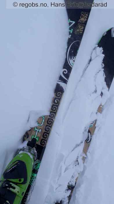
Image 1 of 8 Of: Snow Cover Copyright: Hans Erik@ferdaråd Comment: Tynn myk fokksnø som legger seg til, stort sett ligger den ubunden i leformasjoner og ned mot skogen. Mengde snøfokk på 2 min på andre skia.
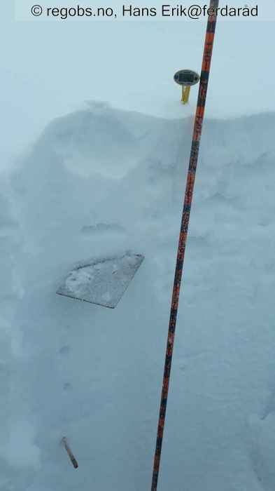
Image 2 of 8 Of: Notes Copyright: Hans Erik@ferdaråd Comment: Ubunden snø, noen steder lett vindpåvirket over 4f fokksnøflak som nok er etter mandagens nordvest-innlasting, som igjen ligger på et tynt skarelag der det observeres rim. Her er snøen i topp mindre påvirket av mildværet, mens noen få meter lengre ned i lendet har det vært større fukttransport og refrysing.
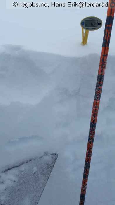
Image 3 of 8 Of: Snow Profile Copyright: Hans Erik@ferdaråd
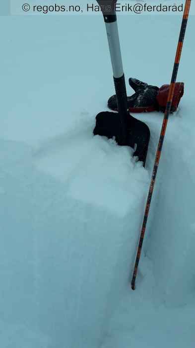
Image 4 of 8 Of: Tests Copyright: Hans Erik@ferdaråd
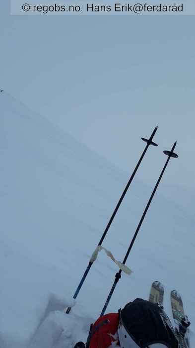
Image 5 of 8 Of: Weather Copyright: Hans Erik@ferdaråd
Image 6 of 8 Of: Snow Profile Copyright: Hans Erik@ferdaråd
Image 7 of 8 Of: Snow Cover Copyright: Hans Erik@ferdaråd Comment: Mye avblåst terreng og lite ubunden snø tilgjengelig.
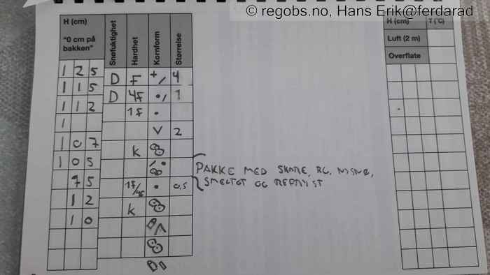
Image 8 of 8 Of: Snow Profile Copyright: Hans Erik@ferdaråd Comment: Rim over skare på i underkant av 20 cm dybde, og både kantkorn og beger under et skarelag 10 cm over bakken. Nysnø fra i dag tidlig i toppen, ellers er snøpakken preget av mildværet langt ned med smelting og refrys og god stabilitet. Dette gjelder også til fjells på 1200 moh.
Danger Sign
• No signs observed • Område: I denne fjellsiden. Beskrivelse: Kjørte over Dovrefjell i natt med god lyssetting av fjellene, i 17 sekundmeter vind. Så ikke noe som helst snøfokk verken på fjellet eller ned Drivdalen, så det konkluderes med at det som fokker nå er det som har kommet i morgentimene.
Weather
• Sleet • -4 °C • 7 m/s from NW ↘ • 100% clouds • Plussgrader opp til 725 moh i dag tidlig, og der nedbøren kom som regn under dette og snø i høyden. Over 1000 moh er det tørrsnø, vind fra NV og det legger seg inn i sø heng. Nå kl 12.30 snør det også lett på 600 moh. 4,3 minus på 1200 m.
Snow Cover
• 100 cm • Some snow drift • 5 cm • Elevation of new snow 725 masl • Wind slab (hard slab) • Dry • Hovedsaklig hardnakket eldre fokksnø, tidvis skare. Snødd 5 cm i høyden siden i dag tidlig, snør fortsatt og blåser noe inn i SØ, S og Ø heng. Myke tynne og harmløse flak. Lett snøfokk i høyden. Snøfordelingen er ujevn i terrenget med mye avblåst på rygger og i hentesider mot vest. Snødybde varierer fra 20-30 cm til meteren på flater med ulik himmelretning med noe mer i lesider. Snødekket ned skogen er stort sett "råttent" under 700 moh ble erfart senere i dag, gjennomfuktet og liten bæreevne.
Avalanche Problems
• Dry slab avalanche • Buried weak layer of surface hoar • Within half a meter • The collapsing weak layer is thin < 3 cm. A big and identifiable crystal in the weak layer. • Difficult to trigger • 2 - Medium • Some steep slopes E, SE, S between 2500 masl and 900 masl • Tror ikke dette har stor utbredelse, har ikke funnet det som problem annet enn i denne hengretningen der det er blåst inn snø tidligere i uken på nordvesten. Lavere enn dette er også snøen mer påvirket av mildværet.
• Dry slab avalanche • Buried weak layer of faceted snow beneath a crust • Over one meter • A big and identifiable crystal in the weak layer. • Very difficult to trigger • 3 - Large • Tør ikke si noe om utbredelse siden det er funnet dypt i snødekket på ett enkelt sted. Det ligger da også dypt og vil ved utbredelse kun være et problem der snødekket er betydelig tynnere. Flere skarelag og harde fokksnøflak over.
Avalanche Danger Assessment
• Mye av den gamle snøen har vært påvirket av mildværet høyt opp den siste uken, og det virker til å være lite spenninger og forholdsvis god stabilitet. Kommer noe påfyll nå. Med viten om et rimlag som kan finnes flere steder, det er observert også i andre himmelretninger, og der dette nå er er relokalisert i samme hengretning som snøen blåser inn, kan jeg ikke annet enn å legge meg på FG2 for den delen av regionen jeg har kjennskap til. • 2 Moderate • Forecast correct • Noe variasjon på skredproblem, ellers stort sett sammenfallende.

