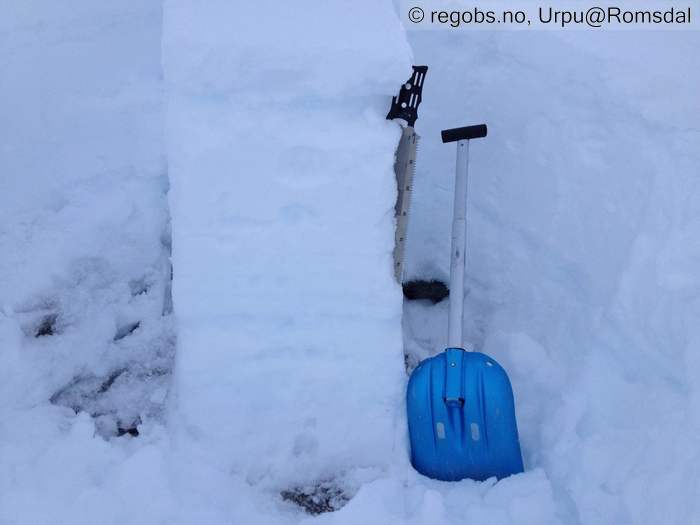
Image 1 of 8 Of: Snow Profile Copyright: Urpu@Romsdal Comment: Fra 1220
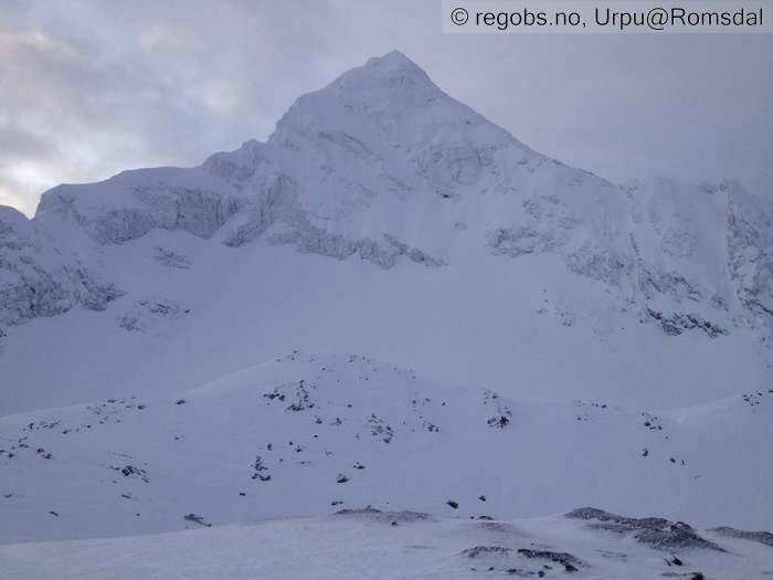
Image 2 of 8 Of: Avalanche Activity Copyright: Urpu@Romsdal Comment: NØ sida, litt flat lys å se skredaktivitet men det er lett nedsnødd bruddkant i midten
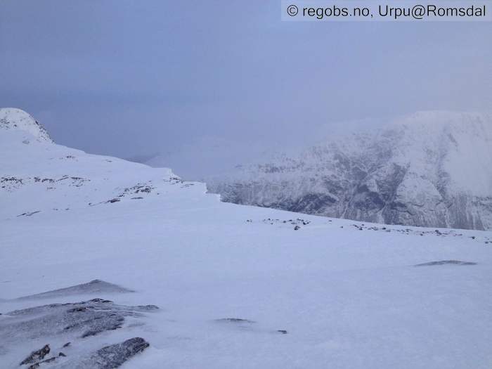
Image 3 of 8 Of: Snow Cover Copyright: Urpu@Romsdal Comment: Glasert overflate og skavler.
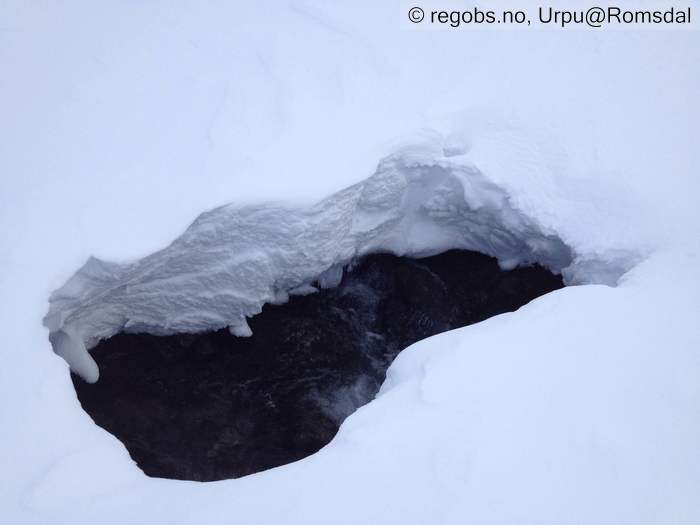
Image 4 of 8 Of: Snow Cover Copyright: Urpu@Romsdal Comment: Åpning i elva rett under 900.
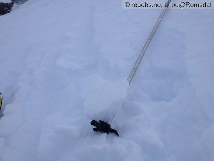
Image 5 of 8 Of: Snow Cover Copyright: Urpu@Romsdal Comment: Brytende skare, her fra ca 900
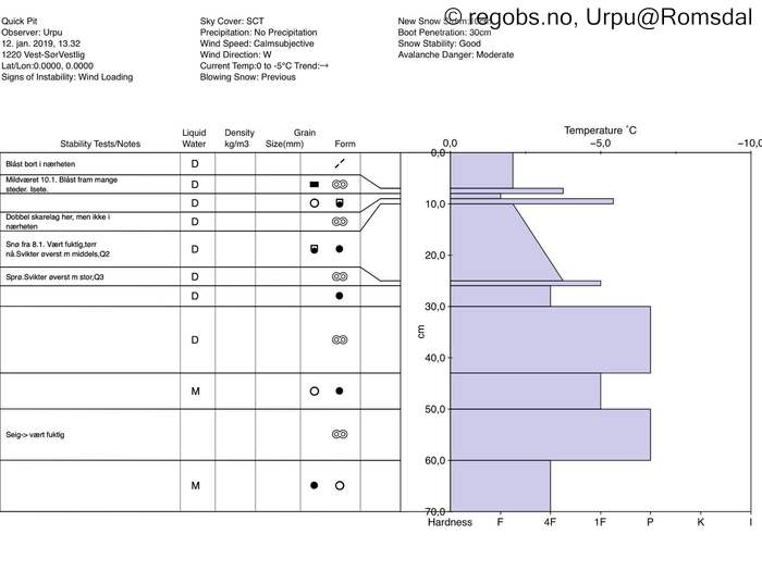
Image 6 of 8 Of: Snow Profile Copyright: Urpu@Romsdal Comment: Fra ca 1220 , vest-sørvest . Flere skarelag som det er lurt å følge med. Fuktig nederst og mot bakken her.
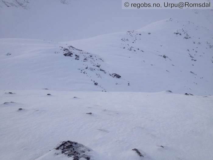
Image 7 of 8 Of: Avalanche Problems Copyright: Urpu@Romsdal Comment: Mye skare og tegn til smelting tidligere her, men noen flekker med fokksnø også.
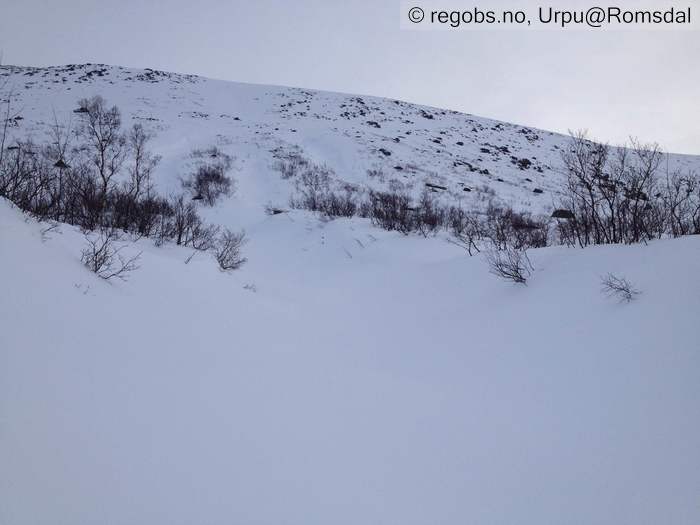
Image 8 of 8 Of: Avalanche Danger Assessment Copyright: Urpu@Romsdal Comment: Lite snø i den vestvendte fjellsiden , og 4 ryper . .
Danger Sign
• No signs observed • Ingen spes faretegn i dag.
Avalanche Activity
• 12. Jan. During the day (+01:00) • No avalanche activity • Ingen dagsferske skred å se men 2 i siste snøen fra igår .
Snow Cover
• 70 cm • No snowdrift • 1 cm • Elevation of new snow 0 masl. Snow line at 100 masl. Layered snow begins at 600 masl • Some loose snow (1-10cm) • Dry • Overflate Også mye glasert, brytende skare (fr ca 800 og oppover) fra Mildvære 10.januar. Den går litt over 1300. Det har begynt å danne kantkorn under den. Der skaren er blåst fram er det litt utfordrende skiføre. Snøen fra i går ligger i terrengformasjoner som samler snø, og den løsnet bare i klumper når en testet det. Det er egentlig ikke så mye snø der jeg gikk i dag. Det er mer og normalt høgare oppe, og mer i andre himmelretninger.
Tests
• @11cm(Q2) • Lille blokktest, svikter med middels tilleggslast begynnende kantkorn
• @27cm(Q3) • Good • Svikter med ekstra stor tilleggslast ,
Avalanche Problems
• Dry slab avalanche • Buried weak layer of new snow • Within half a meter • The overlying slab is soft. • Difficult to trigger • 2 - Medium • Some steep slopes N, NE, E, SE above 700 masl • Siste vindpåvirka snøen. Fant også begynnende kantkorn men det er ikke problem enda . Tørre skred i dag, kan bli noen våte til mildværsgrensen i morgen , men det er vel ikke meldt plussgrader så høgt oppe. Hvis det kommer mye snø, så kan bli str 3 skred, og nå er det jo en del glatt skare framme også , så ikke sikkert det blir så gode bindinger overalt .
Avalanche Danger Assessment
• Det var en fin vinterdag til fjells i dag. Ingen faretegn der jeg gikk i dag, og fokksnø problemet var nok tydeligere tilstede der det er mer av den siste snøen. Kan nok bli str 2 skred i den. Det er nå en del glatt skare framme over tregrensa, så usikkert hvordan nysnøen som er meldt framover kommer til å binde seg. Skare etter mildværet som var på torsdag 10. januar går litt over 1300 og under den er det begynnende kantkorn . Hvis kaldt nok framover så kan den raskt utvikle seg til et problem. Bør følges med . Det kan dok være en del forskjeller i regionen ift til det . • Stigende med været. • 2 Moderate • Forecast correct

